Green Mountain and Finger Lakes National Forests
Where the camps cluster
The place
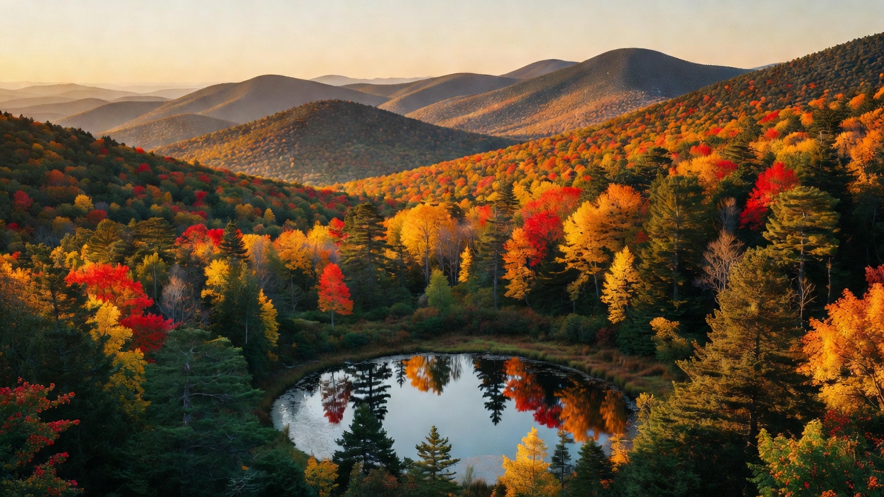
This is one administrative unit running two very different pieces of ground, which the Forest Service does for efficiency while still managing each to its own local needs. The Green Mountain National Forest covers more than 400,000 acres of southwestern and central Vermont, spread across six counties -- Bennington, Addison, Rutland, Windham, Windsor and Washington -- and it is the largest contiguous public land area in the state. This is temperate broadleaf and mixed forest, the New England-Acadian woods: maple, birch and beech over a long north-south granite ridge, cut by gaps, dotted with ponds and beaver flowages, and famous in October for reasons you already know. Two ranger districts split it, Manchester in the south (Massachusetts border up to Route 103) and Middlebury/Rochester through the middle. The Finger Lakes National Forest is the other half of the job: roughly 16,000 acres on the ridge between Seneca and Cayuga lakes in New York, run out of the Hector Ranger Station on State Route 414. Do not go expecting deep woods. It is a patchwork of hemlock and hardwood stands, shrub-lands, open pasture, old roads and a lot of old homestead sites, with vistas west over Seneca Lake, and it is the only national forest in New York. Between the two, the Forest Service manages over 900 miles of trail for summer and winter use, including stretches of three national scenic trails -- the Appalachian, the Long Trail and the North Country. The supervisor's office is in Mendon, Vermont; the developed campgrounds and cabins generally run Memorial Day to Columbus Day and reserve through Recreation.gov.
History
Both halves of this forest are second-chance country. Vermont fed the merino sheep boom -- the animals arrived in 1812 and the state was running a million of them by 1837 -- and the hillsides got stripped to pay for it; when wool fell from 57 cents a pound in 1835 to 25 cents in the late 1840s, the industry collapsed and left the mountains bare. Then came the logging and charcoal era. Glastenbury is the cautionary tale: a town chartered in 1761 that boomed after the Civil War when Bennington money pushed a railroad up the mountain by 1872 and fed dozens of kilns turning the forest into charcoal for iron works in Shaftsbury and Troy. By the late 1880s the trees were gone and so was the economy; the railroad quit in 1889, a 1898 attempt to reinvent the place as a resort died when a freshet tore out the tracks that winter, and the town went from 241 people in 1880 to seven by 1937, when Vermont simply unincorporated it. Most of Glastenbury is inside the national forest now, and the 2020 census counted nine residents. The federal fix for all this was the Weeks Act, signed March 1, 1911, which put $9 million behind the purchase of six million acres of eastern forest land and is the reason cut-over, eroded ground could be bought and healed; Green Mountain is one of the 52 eastern national forests the Forest Service credits to that law. It was established April 25, 1932 -- 102,100 acres at the start, most of it not yet federally owned -- to answer uncontrolled overlogging, fire and flooding. That last word had teeth in Vermont: the flood of November 2-4, 1927 killed 84 people in the state and destroyed or damaged 1,285 bridges, and environmental historians count deforestation among its causes. The New York half has a longer and harder story. This ridge was Haudenosaunee land for thousands of years, hunting country, until the Sullivan Campaign of 1779 burned more than 40 villages and the stores that went with them. In 1790 the ground was carved into 600-acre military lots and handed to Revolutionary War veterans, and farmers worked it for a century until the thin ridge soil beat them -- between the 1890s and the 1930s more than a million acres of farmland went idle across south-central New York. From 1938 to 1941 the federal government bought out more than 100 farms here under Depression-era resettlement programs, and in 1943 the neighbors who stayed formed the Hector Cooperative Grazing Association to run livestock for 120-plus owners on the empty fields. The Forest Service took over management in 1954, ran it as the Hector Land Use Area for decades, and in October 1985 renamed it the Finger Lakes National Forest at local request. In 1996 the old Camp Fossenvue property came in, including the building known as Queen's Castle, listed on the National Register in 1999. The cows never left -- grazing here is a working inheritance, not a re-enactment.
Wildlife & plants
On the Vermont side the cast is classic northern New England: moose, black bear, white-tailed deer, coyote, beaver, wild turkey and ruffed grouse. The beaver do half the landscape architecture -- the first stretch of the Robert Frost Interpretive Trail is a boardwalk across one of their ponds -- and the bears are the reason the forest leads with food-storage warnings on its own home page. Store it right or hang it; a bear that learns to raid a campsite usually ends up dead for it. The forest also has a pest problem worth knowing about: the emerald ash borer, which is why you should burn local firewood and buy the permit rather than hauling wood in from home. New York's half is a different ecosystem entirely, and on purpose. A large proportion of the grasslands on this forest are deliberately kept open with sustainable grazing, because a whole set of grassland-dependent plants and animals need short, open ground that a maturing woodland will not give them -- in the East that habitat is disappearing, so those pastures are doing real conservation work while the cattle eat. The wooded parts are hemlock and hardwood, the edges are shrub-land reverting from pasture, and spring brings bird migration through, plus wildflowers, before the leaves fill in. Berries are a legitimate reason to come: Blueberry Patch Campground is named for the high bush and low bush blueberries beside it, and up in Vermont the old field at the end of the Robert Frost trail carries blueberries and huckleberries, kept open by the Forest Service with prescribed fire.
Notable features
The Long Trail is the headline. Built between 1910 and 1930 by the Green Mountain Club -- the idea was James P. Taylor's in 1909, and twenty-six people met at the Van Ness House in Burlington on March 11, 1910 to start it -- it runs 272 miles up the spine of Vermont from the Massachusetts line to Canada, with another 166 miles of side trails hanging off it. The club calls it the oldest continuous footpath in the country, it inspired the Appalachian Trail, and the AT shares roughly 100 miles of it through southern Vermont. It passes through six of this forest's wilderness areas. There are eight of those in all: Aiken, Big Branch, Breadloaf, Bristol Cliffs, Joseph Battell, Glastenbury, Lye Brook and Peru Peak. Breadloaf is the biggest at 24,986 acres, designated in 1984, named for 3,835-foot Breadloaf Mountain and holding Vermont's own little Presidential Range -- Mounts Wilson, Roosevelt, Cleveland and Grant. Lye Brook, 18,122 acres east of Manchester Center, first protected by the Eastern Wilderness Act of 1975 and expanded in 1984, was logged hard a century ago and has gone quietly feral since; the 1.8-mile spur off the main trail reaches Lye Brook Falls, 125 feet and among the highest in Vermont, where the rocks are slick enough that climbing the falls is a genuinely bad idea. Glastenbury Mountain, 3,748 feet, carries the Long Trail and the AT over its summit and has an observation tower on top maintained by the Green Mountain Club, with a shelter three-tenths of a mile south. Farther north the Long Trail crosses 4,083-foot Mount Ellen, tied with Camel's Hump for third-highest in Vermont, at the forest's northern edge. Two national recreation areas round out the Vermont side: White Rocks, 36,400 acres from 1984, and Moosalamoo, about 15,900 acres designated under the New England Wilderness Act of 2006 between Middlebury and Brandon. And the Robert Frost Interpretive Trail off Route 125 is the easy one worth doing anyway -- a National Recreation Trail with his poems mounted along it in the woods and fields, the first 0.3 mile boardwalked and wheelchair-accessible out to the South Branch of the Middlebury River. In New York, the Interloken Trail is the through-line: a branch of the statewide Finger Lakes Trail system that runs the length of the forest north to south, steeper and more wooded in the south, flat and wide open through the pastures in the north, past Foster and Teeter ponds with big views west to Seneca Lake. Expect to walk through gates -- close them behind you -- and expect mud in spring and fall. Camping is small-scale and honest: Blueberry Patch has nine semi-primitive sites at $15 a night, self-pay, with vault toilets, a 14-day limit in any 30 days and no potable water; Backbone Horse Campground is built for people who arrive with horses; Potomac is the group site.
Camps are sourced from public U.S. Forest Service recreation data and have not been personally visited. Roads shown are Forest Service passenger-car routes (maintenance level 3–5) and may be seasonal or gated. Always confirm access, fees and fire rules with the ranger district before you go. Found a fee where we show free? Tell us on the contact page.