Lincoln National Forest
Where the camps cluster
The place
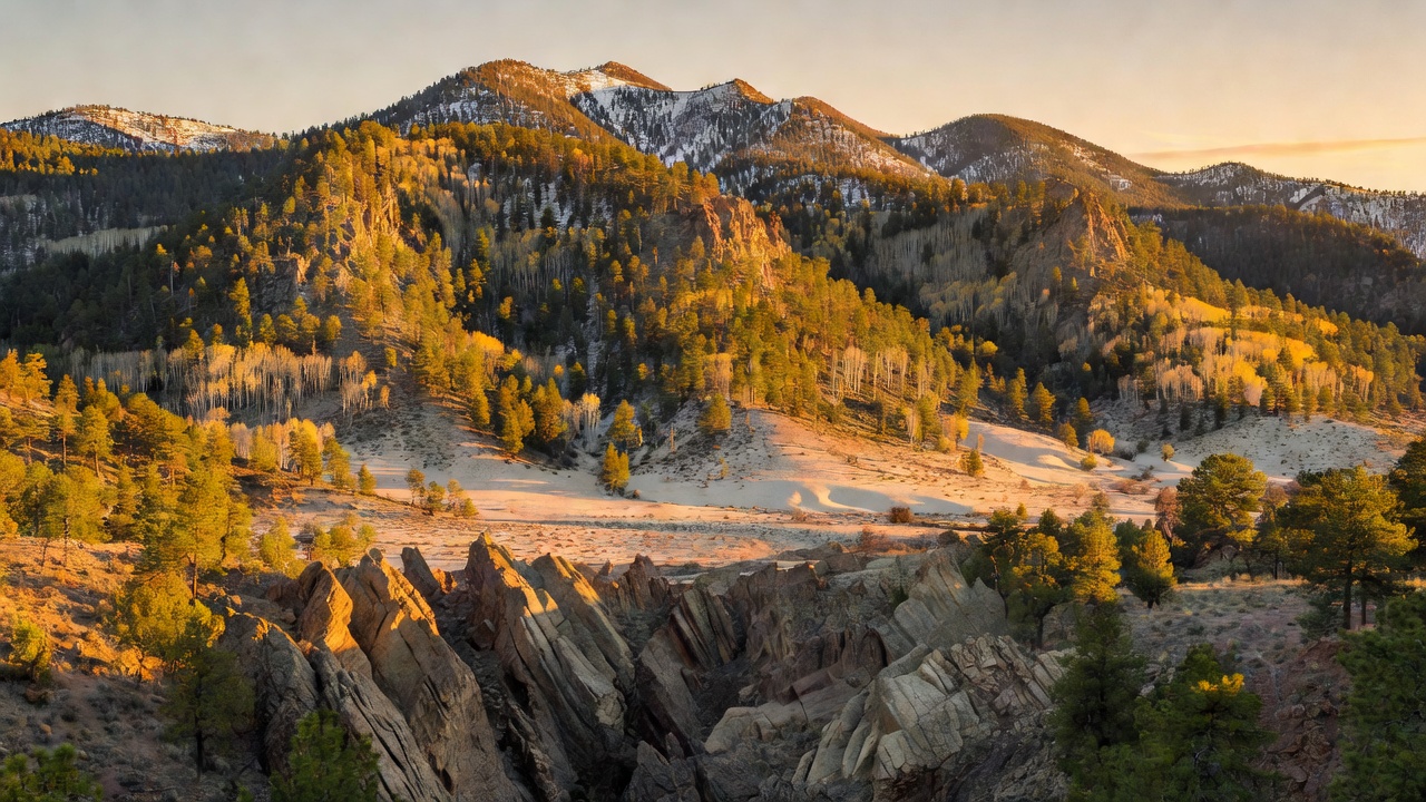
Lincoln National Forest covers more than a million acres of southeastern New Mexico, spread across parts of Chaves, Eddy, Lincoln and Otero counties. What throws most first-timers is that it is not one continuous belt of timber -- it is three distinct mountain ranges, run as three ranger districts, with a lot of desert in between. The Smokey Bear district, out of Ruidoso, takes in the Sierra Blanca high country and the Capitan Mountains. The Sacramento district, out of Cloudcroft, holds the long limestone spine above the Tularosa Basin. The Guadalupe district, out of Carlsbad, is the driest and strangest of the three: an arid karst country of limestone ridges and caves that runs south into Texas. The Forest Service lists the whole unit's elevation range as 4,000 to 11,500 feet, and that gradient is the whole point of the place. Vegetation stacks up in bands as you climb -- desert shrub, then piñon, pine and juniper, then mixed conifer, then subalpine grassland above the trees. Cloudcroft, the little railroad-era resort village sitting in the middle of the Sacramento district at 8,676 feet, exists precisely because people wanted out of the heat. Down in the basin below it, White Sands shimmers in the sun. Up here it snows.
History
This forest was assembled out of pieces. The Lincoln Forest Reserve came first, set aside by presidential proclamation on July 26, 1902 at 545,256 acres, followed by the Gallinas Forest Reserve on November 5, 1906, the Guadalupe National Forest on April 19, 1907, and the Sacramento National Forest five days later on April 24, 1907. Theodore Roosevelt's Executive Order 908 in 1908 folded them into a single Lincoln National Forest, and in 1917, under Woodrow Wilson, the lands of the old Alamo National Forest were transferred in as well. The other founding story here is the railroad. In 1898 the El Paso and Northeastern -- the Eddy brothers' line -- pushed a survey crew into the Sacramento Mountains looking for timber to cut into railroad ties, and the crew came back talking about the view instead. The Cloud-Climbing Railroad that followed hauled lumber, mail and tourists up out of the desert on a spectacular set of wooden trestles; the pavilion opened in June 1899, the depot in June 1900, and three trains a day ran to the new village of Cloudcroft. The automobile ended it -- passenger service stopped in 1938 and the last freight train came down in 1947 -- but the 320-foot Mexican Canyon Trestle still stands over its canyon near Cloudcroft, 52 feet above the floor, one of the most photographed pieces of dead railroad in New Mexico. And then there is 1950. The Capitan Gap fire burned through the Capitan Mountains that spring, and in the aftermath a five-pound black bear cub was found alive with his paws and hind legs burned. Ray Bell of the New Mexico Department of Game and Fish got him out. The crews called him Hotfoot Teddy at first, but the Forest Service and the Ad Council had already been running a cartoon fire-prevention bear since August 9, 1944, and the living cub was renamed to match. He was flown to the National Zoo in Washington on June 27, 1950 and stayed 26 years, pulling in more than 13,000 letters a week -- enough that the Postal Service gave him his own ZIP code, 20252, in 1964. He died on November 9, 1976 and was brought home, and he is buried at Smokey Bear Historical Park in Capitan, run by New Mexico State Forestry. Fire is still writing this forest's history: the South Fork and Salt fires, both started by lightning on June 17, 2024, burned 17,569 and 7,939 acres respectively, ran to 15,000 acres inside the first 24 hours, and threatened Ruidoso before reaching 99% containment on July 15. The Forest Service is still doing flood mitigation in the South Fork scar and replanting the Blue 2 scar on the Smokey Bear district.
Wildlife & plants
The mammal list up in the high country reads like a Southwest sampler: mule deer, elk, black bear, turkey, porcupine, badger, bobcat, gray fox, coyote and skunk all move through the White Mountain Wilderness, and birders come for northern three-toed woodpeckers and Clark's nutcrackers in the conifers. Four life zones stack up in that one wilderness alone -- piñon-juniper, ponderosa pine, mixed conifer, and subalpine forest, with meadows opened up by old fires. The animal worth knowing about, though, is small, damp and easy to miss. The Sacramento Mountain salamander is a lungless salamander -- it breathes through its skin -- and it is endemic to New Mexico, living in just three mountain areas on earth: the Capitan Mountains, the Sierra Blanca range and the Sacramento Mountains. That is, essentially, this forest. It wants cool, wet, shaded ground above about 7,900 feet, on north- or east-facing slopes under Douglas-fir, Engelmann spruce and white fir, and it spends its life in leaf litter and rotting logs. The IUCN lists it as Near Threatened. The plants are just as particular: the Sacramento prickly poppy is federally endangered and the Sacramento Mountains thistle is listed as threatened, and neither grows anywhere but here. Down in the Guadalupe district the whole cast changes over to Chihuahuan Desert species on limestone -- a different world entirely, sixty-odd miles and several thousand feet away from the spruce.
Notable features
Sierra Blanca Peak, at 11,981 feet, is the high point of southern New Mexico and the most southerly peak above 11,000 feet in continental North America -- it misses being the most southerly ground above 12,000 feet by nineteen feet. Its 5,533 feet of prominence is the greatest of any peak in the state. It is the eroded core of a stratovolcano complex that erupted roughly 38 to 26 million years ago and put out something like 185 cubic miles of material. Note that the summit itself sits on the Mescalero Apache Reservation, is sacred to the Mescalero, and requires a tribal permit to reach; Ski Apache, on its slopes, is a tribal enterprise and the southernmost major ski resort in North America. The forest land around it is the White Mountain Wilderness -- roughly 47,000 acres, first protected as a primitive area in 1933, made wilderness in 1964 and expanded in 1980 -- climbing from 6,400 feet at Three Rivers Campground to 11,580 feet near Lookout Mountain, with close to two dozen maintained trails and the 20-mile Crest Trail (T25) running its length. East of there, the Capitan Mountains run an unusual straight east-west line for about 20 miles, a granite intrusion entirely inside the forest, topped by an unnamed 10,201-foot summit that beats Capitan Peak by 118 feet; 34,000 acres of it became the Capitan Mountains Wilderness in 1980. In the Sacramento district, the Sunspot Scenic Byway runs 15.5 paved miles from Cloudcroft down the ridge to Sunspot and the National Solar Observatory, home of the Richard B. Dunn Solar Telescope -- at its 1969 inauguration, the world's premier high-resolution optical solar telescope. The byway's highway number is a joke only astronomers get: it is NM 6563, for the 6,563-angstrom hydrogen-alpha line the observatory uses to watch the sun's chromosphere, and since 2011 the roadside carries planet markers laid out as a 1:250-million scale model of the solar system. Far to the south, the Guadalupe district holds the best surprise: Sitting Bull Falls, a series of cascades dropping about 150 feet into a desert canyon southwest of Carlsbad, fed by springs in the canyon above, with pools you can wade in at the bottom and Civilian Conservation Corps stonework from 1940 around the picnic area. Most of the water then vanishes into gravel and cracks in the rock and goes underground toward the Pecos. That whole district is built on the Capitan Reef -- a Permian fossil reef roughly 250 million years old, one of the clearest exposures of an ancient reef anywhere on earth, the same limestone that Carlsbad Caverns and Lechuguilla are dissolved into a little further east.
Camps are sourced from public U.S. Forest Service recreation data and have not been personally visited. Roads shown are Forest Service passenger-car routes (maintenance level 3–5) and may be seasonal or gated. Always confirm access, fees and fire rules with the ranger district before you go. Found a fee where we show free? Tell us on the contact page.