Little Missouri National Grassland
Where the camps cluster
The place
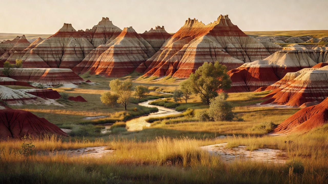
This is western North Dakota, and the country does not look like the rest of the state. Little Missouri National Grassland spreads across McKenzie, Billings, Slope and Golden Valley counties, and its predominant feature -- the Forest Service's own words -- is "colorful and beautiful badlands, a rugged terrain extensively eroded by wind and water." Underneath the erosion it is mixed-grass prairie with both long and short grass: western wheatgrass, needle-and-thread, blue grama, little bluestem and needleleaf sedge on the flats and shoulders, with cottonwood down along the water and pockets of ponderosa pine and columnar juniper on the broken ground. The Little Missouri River is the reason any of it exists. It runs 560 miles from Wyoming's Crook County through Montana and the corner of South Dakota to Lake Sakakawea, it entrenched itself during the Pleistocene, and it has been cutting down through soft sandstone, siltstone, mudstone and bentonite clay ever since. The single most important thing to understand before you come is that this is not one continuous block of public land. Significant portions of the ground inside the boundary are state-owned and privately owned, much of it leased to cattle ranchers for grazing -- so the fence in front of you is as likely to be somebody's ranch as the next piece of grassland. Layered on top of that is oil: the Bakken formation lies underneath, and the Forest Service manages energy development here jointly with the BLM and the State of North Dakota. Expect pump jacks, gravel pads and truck traffic in the same view as the buttes. The Forest Service runs the place from the Dakota Prairie Grasslands supervisor's office in Bismarck, with the McKenzie Ranger District out of Watford City handling the north and the Medora Ranger District the south. Medora is the usual gateway town on the south end, Watford City on the north. And the three units of Theodore Roosevelt National Park -- another 70,446 acres -- sit inside the grassland's borders but are run by the National Park Service under completely different rules. Know which one you are standing on.
History
Long before any of the modern names, the Mandan, Hidatsa, Crow, Blackfeet, Sioux and other tribes moved through this country, and the Forest Service is explicit that those nations retain spiritual and cultural connections to it today. The chapter most visitors have heard of started in September 1883, when a 24-year-old New York assemblyman named Theodore Roosevelt got off the train to shoot a bison. He liked it enough to put $14,000 into the Maltese Cross Ranch about seven miles south of Medora, already being run by Sylvane Ferris and Bill Merrifield. Then on February 14, 1884, his wife and his mother died on the same day, and Roosevelt came back here looking for somewhere to be alone. That summer he set up the Elkhorn Ranch some 35 miles north of Medora and brought in two Maine woodsmen, Bill Sewall and Wilmot Dow, to work it. The winter of 1886-87 ended the experiment -- it devastated the northern plains cattle business through mass starvation losses -- but the badlands had already done their work on him. He wrote three books out of it, and the man who came out here to kill things went on to a presidency defined by protecting them. The ground itself has a rougher story. Homesteaders came in from the late 1800s to ranch and farm, plowing land that was never suited to it, and the consequences fed straight into the Dust Bowl of the 1930s. The federal response built this grassland: the Soil Conservation Service was created in 1933, and Title III of the Bankhead-Jones Farm Tenant Act of 1937 authorized the government to buy submarginal land out from under struggling homesteaders and repair it. The transfer to the Forest Service and the formal designation took years to work through -- Wikipedia dates this grassland's establishment to June 23, 1960, part of a national system that by 2007 counted 20 national grasslands totaling 3,838,280 acres. So the largest grassland in America is, in plain terms, a couple thousand failed farms that the country bought back and put together again. The park came later still: the area was a Roosevelt Recreation Demonstration Area in 1935 and a national wildlife refuge in 1946 before Theodore Roosevelt National Park was established on November 10, 1978.
Wildlife & plants
The badlands animal worth planning around is the bighorn sheep. The Forest Service says the bighorn found here are the only ones you will find in the state, and they hold to the steep, broken terrain along the Little Missouri River precisely because predators cannot work it -- the National Park Service points to the North Unit as the place to look. Beyond that it is big-country grazing stock: elk, pronghorn (the fastest land mammal in North America), mule deer, white-tailed deer, and bison inside the national park units, which are NPS-managed and not roaming the grassland at large. Coyotes are the predator you are most likely to actually see. American badgers work the edges of black-tailed prairie dog towns, and those towns are worth stopping for -- the burrowing is extensive enough to reshape the ground around it, and western burrowing owls live in them. The owls are protected and may not be shot; know the difference before you raise anything. Grassland biologists here monitor three prairie grouse -- sharp-tailed grouse, greater sage-grouse and greater prairie chickens -- at their dancing grounds every spring, and the bird list also runs to eagles, prairie falcons, western meadowlarks, upland sandpipers, pheasants and wild turkeys; the park alone has recorded more than 186 species passing through or living there. For reptiles, this is prairie rattlesnake country, along with bullsnakes, plains hog-nosed snakes and smooth green snakes -- watch where you put your hands on warm rock. Fishing is modest and real: Sather Lake holds crappie, trout and bass, and the Little Missouri River itself gives up channel catfish and sauger.
Notable features
The Maah Daah Hey Trail is the headline. It runs 144 miles of non-motorized singletrack from the Burning Coal Vein Campground, about 49 miles south of Medora, north to the CCC Campground about 16 miles south of Watford City, crossing rolling prairie, clay buttes, canyons, gullies, steep rocky ground and the Little Missouri River itself. Every motorized vehicle is banned on it, e-bikes included, which leaves hikers, mountain bikers and horses. Eight Forest Service campgrounds string along the route -- Burning Coal Vein, Wannagan, Buffalo Gap, Bennett, Coal Creek, Elkhorn, Magpie and CCC -- so you can ride it in sections without a shuttle problem. Its name comes from the Mandan and is generally translated as an area that has been or will be around for a long time. It is a National Recreation Trail and is widely billed as the longest continuous singletrack mountain bike trail in America, though bikes are not allowed on the trails inside Theodore Roosevelt National Park, so alternate routing works around the park units. The south trailhead is worth a look on its own: Burning Coal Vein Campground has eight spread-out sites with fire rings and picnic tables, gravel pads long enough for a 60-foot rig, a vault toilet and a hand pump, at $10 a night in a fee tube, with views over badlands, columnar juniper and ponderosa pine. It is named for the geology that makes this place red. Lignite coal seams run through these hills, and lightning or a prairie fire can set one burning underground for years; the fire bakes the mud and sand above it into a hard, brick-like rock the locals call scoria -- properly clinker -- and its red comes from iron oxidizing in the heat, not from any volcano. Clinker resists erosion better than the soft stuff around it, which is why it caps so many of the buttes. Silica-rich groundwater did something similar to the old buried forests and left petrified wood behind. The other landmarks: the three park units, the Ice Caves on the Medora district's stretch of the Maah Daah Hey, and White Butte -- North Dakota's highest point, out in the extreme southeast corner south of Amidon.
Camps are sourced from public U.S. Forest Service recreation data and have not been personally visited. Roads shown are Forest Service passenger-car routes (maintenance level 3–5) and may be seasonal or gated. Always confirm access, fees and fire rules with the ranger district before you go. Found a fee where we show free? Tell us on the contact page.