Los Padres National Forest
Where the camps cluster
The place
Los Padres covers the Coast and Transverse Ranges of central and southern California, and the first thing to understand is that it is not one place. The forest is split into two non-contiguous sections that sit roughly 40 to 50 miles apart. The northern division is in Monterey County and northern San Luis Obispo County and includes the Big Sur coast; the much larger main division runs through San Luis Obispo, Santa Barbara, Ventura and Kern counties, with a small extension into Los Angeles County. About 88 percent of what is inside the boundary is public land -- the rest is privately owned inholdings, so a boundary line on a map is not a promise that you can camp there. The supervisor's office is in Solvang, with district offices historically at Frazier Park, King City, Ojai, Santa Barbara and Santa Maria.
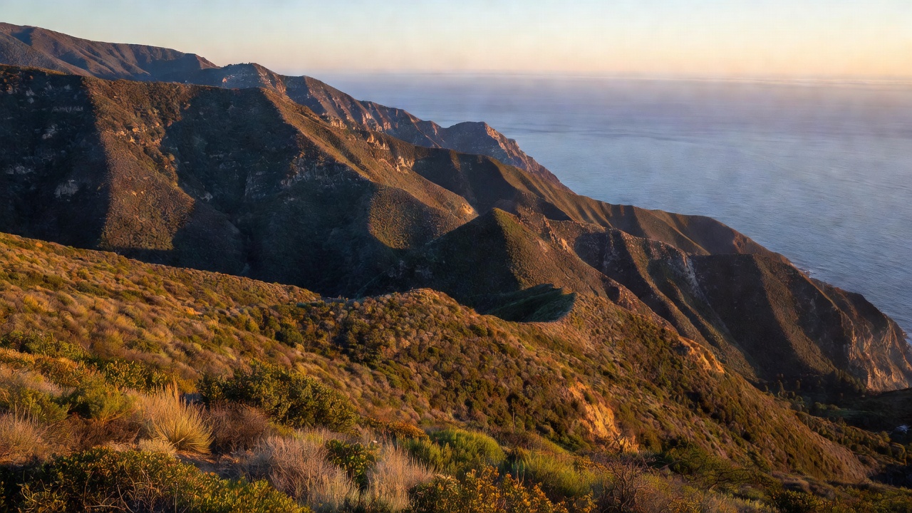
Now reset what "forest" means. The dominant vegetation here is chaparral -- dense, waist-to-head-high brush that is beautiful from a ridge and close to impassable off-trail. There are real conifers, but old growth accounts for only about 18,900 acres of the whole forest, largely Jeffrey pine plus coast redwood, Douglas-fir and white fir. Elevations run from sea level to 8,847 feet at Mount Pinos, the highest point in Ventura County. In the north, the Santa Lucia Range -- which runs "from Carmel southeast for 140 miles to the Cuyama River" -- forms what geographers call the steepest coastal slope in the contiguous United States. Shade is a local event out here, not a general condition.
For campers, the developed side is modest for a forest this size: the forest's own recreation listing runs to about 53 entries -- roughly 50 campgrounds, a couple of group campgrounds and a camping area -- with names like Arroyo Seco, Aliso Park, Bates Canyon, Caballo and Campo Alto. The forest states flatly that "there are no cabins on the Los Padres National Forest, only campgrounds," so don't go looking for a rental with a roof. Reservations are handled through Recreation.gov and are, in the forest's own words, "highly recommended." Note also that a National Forest Adventure Pass -- the regional day-use pass shared by the Angeles, Cleveland, Los Padres and San Bernardino forests -- is required for parking at many locations here. You don't need one to simply drive through, or to stop for a stretch break or a photo, and you don't need one where a site-specific fee is already charged.
Dispersed camping follows the standard Pacific Southwest pattern: camping outside a designated campground, no piped water and no toilets, not permitted in the vicinity of developed recreation areas such as campgrounds, picnic areas or trailheads, sites at least 150 feet from any stream or water source, and a stay limit that the region describes as "usually 14 days, but this can be further limited in some National Forest areas." As always here, the local district office is the authority on what is currently open.
The rule that catches people out is fire. A California Campfire Permit is required year-round for campfires, charcoal grills, gas stoves and lanterns outside developed recreation areas -- and on this forest the requirement is spelled out by county: year-round in Ventura and Santa Barbara counties, and from May 1 through fire season in Kern, San Luis Obispo and Monterey counties. Yes, that includes your backpacking stove. Check current restrictions before you go, because in a bad year the permit exists and the fire still isn't allowed.
History
The forest was assembled out of pieces, and the pieces are older than the name. The Pine Mountain and Zaka Lake Forest Reserve was set aside on March 2, 1898, the Santa Ynez Forest Reserve on October 2, 1899, the Monterey National Forest on June 25, 1906, and the San Luis National Forest on July 1, 1908. Consolidated, they became the Santa Barbara National Forest -- a name that, as the record dryly puts it, "was resented by residents of the other counties for being too closely identified with just the one county." On December 3, 1936 it was renamed Los Padres, "the Fathers," after the Catholic missionary priests of the Spanish missions. Four counties got a name none of them had to lose an argument over.
The people who were here first were the Chumash, whose territory covered portions of what became Kern, San Luis Obispo, Santa Barbara, Ventura and Los Angeles counties, "extending from Morro Bay in the north to Malibu in the south to Mount Pinos in the east" -- which is very close to a description of this forest. They were a maritime people: the tomol, a sewn-plank canoe, carried goods along the coast and out to the islands and could be used for whaling. Spanish missions relocated most Chumash between 1772 and 1817, and a population estimated at 10,000 to 20,000 before contact had fallen to roughly 200 by 1900. Descendant communities are still here -- the Santa Ynez Band of Chumash Mission Indians holds federal recognition, and around fourteen distinct bands exist today, some still seeking it. Their rock art is scattered through the backcountry, and the forest maintains interpretive Chumash cultural heritage sites.
Condor protection on this ground predates the Endangered Species Act by decades. The Sisquoc Condor Sanctuary was created in 1937 and is the oldest designated sanctuary for the birds anywhere. The 53,000-acre Sespe Condor Sanctuary followed in 1947, in the Topatopa Mountains of northeastern Ventura County. Two refuges, set aside a full fifty years before the species hit bottom -- which turned out to matter enormously.
Los Padres also holds a first in American wilderness law. The San Rafael Wilderness was formed in 1968 as the first wilderness area created from a previously designated Primitive Area after the Wilderness Act of 1964 -- the new system's opening move, and it happened here. The Ventana Wilderness was formally established on August 18, 1969 and has since been expanded by five separate acts of Congress between 1969 and 2002. In 1992 the Los Padres Condor Range and River Protection Act created the 219,700-acre Sespe Wilderness and added roughly 48,210 acres to the San Rafael. The forest now carries ten wildernesses -- Ventana, Silver Peak, Santa Lucia, Garcia, Machesna, San Rafael, Dick Smith, Matilija, Sespe and Chumash -- totaling something on the order of 1,263 square miles, about 48 percent of the whole forest.
And then there is the fire history, which on this forest is not a footnote. The Marble Cone Fire burned 178,000 acres in 1977; the Basin Complex Fire took 162,818 acres in 2008. The Thomas Fire started December 4, 2017, burned until January 12, 2018, covered 281,893 acres across Ventura and Santa Barbara counties, and destroyed at least 1,063 buildings; investigators concluded that Southern California Edison equipment sparked both ignitions. It was briefly the largest wildfire in modern California history and as of 2025 ranks eighth. What followed was worse in the way that matters: January rain on bare, burned slopes produced the Montecito debris flows, which killed 21 people and destroyed 129 residences. A December fire in this country is not an anomaly. It is the climate you are camping in.
Wildlife & plants
The California condor is the headline, and it earns it. It is the largest land bird in North America, with a wingspan of about 9.8 feet and a lifespan of up to 60 years. In 1987 every remaining wild bird was captured for a breeding program; 22 condors existed on earth. The total population had grown to 607 individuals as of December 2025, with release sites including Big Sur and Pinnacles National Park in California, Vermilion Cliffs in Arizona, Zion in Utah and the Sierra de San Pedro Martir in Baja California. Lead poisoning is still the greatest danger to the wild population -- condors scavenge carrion and swallow ammunition fragments with it, and the recovery of a genuinely self-sustaining population depends on hunters moving to non-lead ammunition.
The two sanctuaries -- Sisquoc in the San Rafael Wilderness, Sespe in the Topatopa Mountains -- are the historic core of that effort, and they are managed for the birds rather than for visitors. The practical advice for a camper is simpler: you don't hunt for condors, you look up. Mount Pinos hosts one of the most significant populations of birds of prey in California, condors included, and the Big Sur coast is an active release area. If a bird passes over and your first thought is "that's not a turkey vulture," you are probably right -- the size difference is not subtle.
The rest of the cast is classic coastal California: mountain lions, black bears, bighorn sheep and peregrine falcons, plus five owl species and northern goshawks up around Mount Pinos. Store food properly for bears and take the standard mountain-lion precautions -- keep kids and dogs close at dawn and dusk, and don't run.
The plant life is where this forest gets genuinely strange. Chaparral rules the mid-elevations, but the deep canyons of the Ventana Wilderness hold stands of coast redwood, some of it old growth, and the Santa Lucia Range shelters the Santa Lucia fir -- also called bristlecone fir -- which is described as one of the rarest and most endemic firs in North America. Cone Peak carries colonies of it alongside old-growth sugar pine. Roughly 57 plant species are found exclusively in the Santa Lucias. In spring, Figueroa Mountain is the forest's wildflower showpiece.
Notable features
The Ventana Wilderness is the Big Sur backcountry: "steep-sided, sharp-crested ridges separating V-shaped youthful valleys," narrow vertical-walled canyons with waterfalls and deep pools, thermal springs, and redwoods in the folds. It runs from about 600 feet to 5,750 feet and covers roughly 375 square miles. The name comes from a notch called "The Window" -- ventana in Spanish -- on a ridge near Ventana Double Cone. Its centerpiece is Cone Peak at 5,155 feet, which "rises nearly a vertical mile only 3 miles from the coast as the crow flies" -- an average gradient of about 33 percent, steeper than the climb from the Owens Valley to the summit of Mount Whitney. A 1923 fire lookout still stands on top; it was last staffed in 1990.
The San Rafael Wilderness is the original one. It runs between the San Rafael and Sierra Madre ranges, from 1,166 feet at the confluence of Manzana Creek and the Sisquoc River up past 6,800 feet on Big Pine Mountain. Its defining feature is Hurricane Deck, "a rugged 15-mile slab of upthrust sandstone" that splits the drainages. Chumash rock art is scattered across the region, with pictographs found in the grassy openings called potreros -- and the Sisquoc Condor Sanctuary sits inside it.
Sespe Creek, in the Sespe Wilderness, is "one of the last free-flowing, untamed streams in Southern California" -- an increasingly rare thing in a state built on dams. The surrounding wilderness is chaparral, oak woodland and riparian corridor studded with waterfalls, hot springs and rock formations. The Piedra Blanca trailhead is the usual way in, following the creek up into the canyons toward Willett Hot Springs.
Mount Pinos is the forest's high point at 8,847 feet, and one of the more culturally significant summits in California. The Chumash call the mountain 'Iwihinmu, "a place of mystery," and the summit area Liyikshup, "center of the world." It is also one of the best stargazing sites in Southern California -- relatively low light pollution and frequently clear skies -- which makes it a standing favorite with amateur astronomers. Treat the summit as the sacred place it is.
The Big Sur coast belongs to this forest too. The northern division touches one of the most photographed coastlines in the world, and the forest's own description of "the beautiful Big Sur Coast and scenic interior areas" undersells it. Access here is weather- and slide-dependent in a way that catches visitors off guard; check road status before committing to a route.
One more thing worth stating plainly, because it is unusual in California: no wilderness permit. The forest says "you do not need a wilderness permit or pass for any of the wildernesses in the Los Padres National Forest." Travel in groups of 25 or fewer, leave the mountain bike at home -- all mechanical transport is prohibited in wilderness, though wheelchairs are fine -- and carry that campfire permit.
Camps are sourced from public U.S. Forest Service recreation data and have not been personally visited. Roads shown are Forest Service passenger-car routes (maintenance level 3–5) and may be seasonal or gated. Always confirm access, fees and fire rules with the ranger district before you go. Found a fee where we show free? Tell us on the contact page.