Modoc National Forest
Where the camps cluster
The place
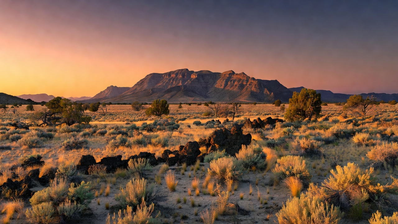
Modoc National Forest occupies the far northeastern corner of California -- remote, high-elevation volcanic country spread across parts of Modoc, Lassen, and Siskiyou counties, with its headquarters in the little ranching town of Alturas. This is the Modoc Plateau: a vast, dry tableland built up by immense lava flows over roughly the last 500,000 years, sitting at the crossroads where the Cascade Range, the Sierra Nevada, and the Great Basin desert all meet. It is big, open, sagebrush-and-juniper high desert broken by two great highlands -- the sharp fault-block Warner Mountains along the eastern boundary and the broad Medicine Lake shield volcano to the west -- and stitched together with pine forest, wet meadows, cinder cones, and scattered lakes. Far from any interstate and lightly visited, it's some of the quietest public land in the state.
History
The land was set aside as the Modoc Forest Reserve on November 29, 1904, passed to the new U.S. Forest Service in 1905, and was formally proclaimed Modoc National Forest on March 4, 1907; the separate Warner Mountains National Forest was folded into it on July 1, 1908. The forest carries the name of the Modoc people, who lived in this high lava country long before any of that. Their story here is a hard one: after being forced onto the Klamath Reservation, a band led by Kintpuash -- known to settlers as Captain Jack -- returned to their homeland, and in 1872-1873 fought the U.S. Army in the Modoc War, a bitter standoff waged from the natural rock fortresses of the lava beds just northwest of the forest. It was one of the costliest of the Indian Wars for its size; Captain Jack was executed in 1873, and the surviving Modoc were removed to Indian Territory in present-day Oklahoma.
Wildlife & plants
The high country is Rocky Mountain mule deer range, hunted by mountain lions and prowled by bobcat, coyote, and the elusive American marten; beaver work the streams, and black bears turn up, though they're uncommon here compared with the wetter forests to the west. The forest sits squarely on the Pacific Flyway, so its meadows, marshes, and lakes fill with migrating birds. Perhaps its most famous residents, though, are the wild horses of the Devils Garden -- the largest wild horse territory the Forest Service manages anywhere. The plant life climbs with elevation, from bitterbrush and curl-leaf mountain mahogany on the low flats up through western juniper and ponderosa and Jeffrey pine to white and red fir, incense cedar, and aspen, and finally to lodgepole and whitebark pine on the highest Warner ridges.
Notable features
The two showpieces sit at opposite ends of the forest. In the east, the South Warner Wilderness protects more than 70,000 acres of the Warner Mountains -- a fault-block range that rears up steeply on its eastern face and slopes gently away to the west -- crowned by Eagle Peak at 9,895 feet and traced end to end by the long Summit Trail. In the west lies part of the Medicine Lake Highlands, built around Medicine Lake Volcano: a low, broad shield that, by the sheer volume of rock it has erupted, is the largest volcano in the whole Cascade Range, its flanks studded with young obsidian flows like Glass Mountain, which last erupted only around a thousand years ago. Between the two highlands spreads the Devils Garden, a juniper-dotted plateau roamed by wild horses, and the forest is dark and empty enough to hold a designated dark-sky sanctuary for stargazing.
Camps are sourced from public U.S. Forest Service recreation data and have not been personally visited. Roads shown are Forest Service passenger-car routes (maintenance level 3–5) and may be seasonal or gated. Always confirm access, fees and fire rules with the ranger district before you go. Found a fee where we show free? Tell us on the contact page.