Pike and San Isabel National Forests
Where the camps cluster
The place
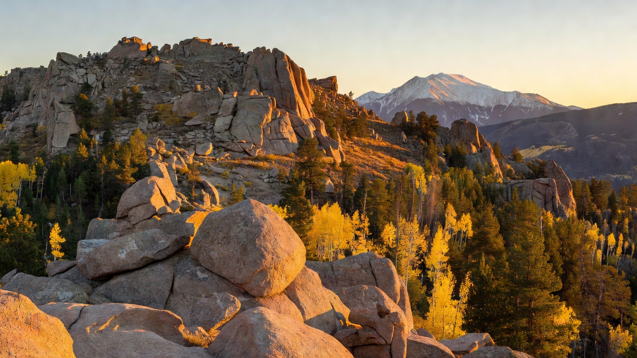
Pike and San Isabel are two separate national forests worked as a single unit, and they do not look much alike. The Pike runs along Colorado's Front Range west of Colorado Springs, across parts of Clear Creek, Teller, Park, Jefferson, Douglas and El Paso counties, drained by the South Platte River and Fountain Creek. Its bedrock is the coarse, pink-to-orange Pikes Peak granite, and that rock is the whole personality of the place -- domes, knobs and tumbled boulder country under the peak that gave it its name. Most of the forest gets more than a hundred inches of snow a year.
The San Isabel sits west and south, spread across eleven central-Colorado counties, and it is mountain country of a bigger order. It takes in a long share of the Sawatch Range along the Continental Divide, the eroded volcanic Mosquito Range, and the narrow, faulted spine of the Sangre de Cristos running down toward New Mexico. Nineteen of Colorado's fifty-three fourteeners stand inside its boundary, Mount Elbert among them. Ranger districts work out of Leadville, Salida and Cañon City.
The two are administered together from a supervisor's office in Pueblo, along with the Comanche National Grassland in Colorado and the Cimarron National Grassland out in Kansas -- an unusual spread that the Forest Service describes as running from western Kansas all the way to Colorado's highest mountain peaks along the Continental Divide. Fishing, hiking, picnicking and camping are the everyday draws, and fire and shooting restrictions are posted often enough that it is worth checking the official page before you load the truck.
History
This is some of the oldest protected forest in the country. The Pike traces to a reserve set aside in February 1892, in the first wave of reserves created after the Forest Reserve Act of 1891; the San Isabel National Forest was established April 11, 1902.
The name on the peak arrived earlier and, fittingly, without a summit. Zebulon Pike, sent out in 1806 to look over the new Louisiana Purchase, tried the mountain and turned back -- most likely beaten by winter conditions. The first documented ascent came on July 15, 1820, when the geologist and botanist Edwin James climbed it with Stephen Long's expedition; on the way up James became the first to describe the blue columbine, now Colorado's state flower. By the 1859 gold rush, newspapers were selling the whole district as 'Pike's Peak,' and 'Pike's Peak or Bust' became the cry of the wagons heading west, even though the serious gold lay elsewhere. In 1893 the poet Katharine Lee Bates reached the summit and came down with the lines that became 'America the Beautiful.'
The high country west of here has a harder history. Mount Elbert carries the name of Samuel Hitt Elbert, territorial governor of Colorado, given by miners because he brokered a treaty with the Ute in September 1873 that opened more than three million acres of reservation land to mining and railroads. The Ute lived in the Collegiate Peaks country, and the mining boom that followed left ghost towns like Winfield and Harrison scattered through the Sawatch. The Spanish name on the Sangre de Cristos -- 'Blood of Christ' -- reflects the religious significance the range held for early Spanish settlers in the region.
Recent decades have been written mostly in fire. The Hayman Fire burned 138,114 acres and 133 homes in 2002, and the Waldo Canyon Fire took 18,247 acres and 346 homes in 2012 -- both on the Pike, both still visible on the ground. In September 2023 the U.S. Geological Survey's Board on Geographic Names approved Mount Blue Sky as the replacement name for Mount Evans, the peak at the heart of the wilderness the Pike shares with the Arapaho.
Wildlife & plants
The classic Colorado high-country animals are all here: black bear, mountain lion, elk and bighorn sheep range the Sangre de Cristo Wilderness, where the forest is largely spruce and aspen. Bighorns are the standout -- the Buffalo Peaks Wilderness, which straddles both forests in the Mosquito Range, holds Colorado's largest population of them, and that is worth knowing before you plan a fall trip up there.
The vegetation stacks up the way it does anywhere in these mountains: forest on the lower and middle slopes, then thinning timber, then bare alpine ground on the fourteeners. Ponderosa pine grows in the Collegiate Peaks country and was used by the Ute for food and clothing. The blue columbine that Edwin James first described on Pikes Peak in 1820 is now the state flower.
There is also an absence worth naming. Lost Park, the basin at the center of the Pike's Lost Creek Wilderness, was one of the last refuges of the American bison in the United States -- a reminder that what you see out here is what survived, not what was always here.
Notable features
Mount Elbert is the headline. At 14,440 feet it is the highest summit in Colorado and in the entire Rocky Mountains, and the second-highest in the contiguous United States after California's Mount Whitney -- and it is a walk-up, not a climb: the standard North Elbert Trail covers about 4.6 miles with roughly 4,500 feet of gain. It stands in the Sawatch Range about twelve miles southwest of Leadville. The Sawatch runs some eighty miles northwest-to-southeast, carries fifteen peaks above 14,000 feet, and is high but gentle in contour, which is why so many of its summits are hikeable.
Wilderness is the other headline. The Collegiate Peaks Wilderness -- 167,414 acres shared with the Gunnison and White River forests, designated in 1980 -- has the highest average elevation of any wilderness area in the United States, and holds Mount Harvard, Mount Yale, Mount Princeton and Mount Columbia along with La Plata Peak, Mount Belford, Huron Peak and Missouri Mountain. The Sangre de Cristo Wilderness (220,803 acres, designated 1993) is long and narrow, shared with the Rio Grande National Forest and Great Sand Dunes National Park and Preserve; Crestone Needle in it is reckoned the hardest fourteener of the group. Buffalo Peaks Wilderness adds 43,410 acres around two badly eroded volcanic summits, and the Mount Evans Wilderness -- 74,401 acres about thirty miles west of Denver, shared with the Arapaho -- takes in the Abyss Lake country on the south side of the peak now named Mount Blue Sky.
On the Pike side, the Lost Creek Wilderness is the one people come back for: 119,790 acres of granite arches and rounded domes in the Kenosha and Tarryall Mountains, with about 130 miles of trail and a section of the Colorado Trail crossing it toward Kenosha Pass. Pikes Peak itself is the easternmost fourteener in the United States, reachable on foot, by the Manitou and Pike's Peak Railway (the world's highest cog railroad) or by the Pikes Peak Highway toll road -- the same road used since 1916 for the Pikes Peak International Hill Climb. Rampart Reservoir sits in the forest above Colorado Springs. Over on the San Isabel, Independence Pass and Cottonwood Pass both top 12,000 feet and are typically open only from late spring to mid autumn, so check before you route through them.
Camps are sourced from public U.S. Forest Service recreation data and have not been personally visited. Roads shown are Forest Service passenger-car routes (maintenance level 3–5) and may be seasonal or gated. Always confirm access, fees and fire rules with the ranger district before you go. Found a fee where we show free? Tell us on the contact page.