Tongass National Forest
Where the camps cluster
The place
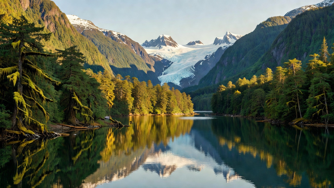
The Tongass is the nation's largest national forest, and it does not look like any other one. It covers most of Southeast Alaska -- the Panhandle -- spilling across nearly 17.7 million acres of the islands of the Alexander Archipelago, the fjords and glaciers cut into the mainland, and the peaks of the Coast Mountains behind them. The Forest Service's own description is that it surrounds the famous Inside Passage, and that is the honest geography of the place: this is a forest you move through by boat and by floatplane more often than by truck.
It is also a lived-in forest. Thirty-one communities sit inside the forest boundary, the largest being Juneau -- the state capital, population about 31,000 -- along with Ketchikan, Sitka, Petersburg and Wrangell. Most of them have no road connection to anywhere else; the Alaska Marine Highway ferry system exists precisely to serve Southeast Alaska towns that have no road access, running some 3,500 miles of routes. What road system does exist in the region was built largely by the Forest Service to enable timber harvest, which is worth knowing before you plan a trip around a map full of promising-looking lines. Forest headquarters is in Ketchikan, on Mission Street.
For campers, that changes the whole shape of the trip. The Tongass leans hard on its public-use cabin system: the Forest Service's own recreation listing for the forest runs to more than 180 cabins and lookouts alongside roughly two dozen campgrounds and camping areas -- simple shelters with bunks and a stove, many of them reached only by water or air. Roughly 1.9 million people visit the Tongass in a year, the bulk of them arriving by cruise ship on the Inside Passage, which means the crowds and the backcountry are startlingly close together and almost never in the same place.
History
The Tongass is named for the Tongass group of the Tlingit people, who lived in the southernmost reaches of Southeast Alaska near what is now Ketchikan -- and the human history here is far older and far more continuous than the federal one. Three Alaska Native nations live in Southeast Alaska: the Tlingit, the Haida and the Tsimshian. In 1968 a landmark court settlement awarded the Tlingit and Haida peoples $7.5 million for aboriginal land claims.
The federal chapter starts on August 20, 1902, when President Theodore Roosevelt created the Alexander Archipelago Forest Reserve. The Tongass National Forest itself was established by presidential proclamation on September 10, 1907, and the two were merged on July 1, 1908; further proclamations expanded the forest on February 16, 1909, and again on June 10, 1925.
Much of the twentieth century here was a timber story. Long-term contracts -- fifty-year deals tied to pulp mills -- drove logging through the 1990s, and the roads you see on the map are mostly their legacy. The Tongass Timber Reform Act of 1990 cancelled what had been a $40 million annual subsidy. More recently the pendulum swung the other way: in 2021 the federal government announced an end to large-scale old-growth timber sales on the forest, and in January 2023 roadless protections were restored. It is fair to say the Tongass has been argued over more than almost any other piece of ground in the system, and that the argument is not finished.
Wildlife & plants
This is Earth's largest remaining temperate rainforest, and it grows the trees to prove it -- Sitka spruce, western hemlock and western redcedar, standing in old growth over deep moss. About 10 million acres of the forest are actually forested; the other 40 percent or so is wetland, snow, ice, rock and non-forest vegetation, which is a useful reminder that a lot of the Tongass is bog, bare stone and glacier rather than timber.
Five species of salmon run these waters, and effectively everything else in the food web is arranged around them. Brown bears and black bears work the spawning streams; bald eagles gather in some of the highest densities found anywhere; wolves, mountain goats and Sitka black-tailed deer fill out the land side. Because the forest is really a coastline, the marine list matters just as much: orca and humpback whales, sea lions, seals, sea otters, river otters and porpoises all use the same passages you'd be paddling. Bear country here is not theoretical -- it is the default condition, and food storage and stream-side awareness are the price of admission.
Notable features
The Tongass holds 19 designated wilderness areas covering more than 5,750,000 acres -- more wilderness than any other national forest. Two of them are the headliners.
Misty Fjords National Monument, about 40 miles east of Ketchikan, is 2,294,343 acres of drowned glacial valley, all but 151,832 acres of it wilderness. President Jimmy Carter proclaimed it in December 1978 under the Antiquities Act, and Congress made it statutory through the Alaska National Interest Lands Conservation Act in 1980. The walls of the fjords are near-vertical, often rising 2,000 to 3,000 feet straight out of the sea and dropping another 1,000 feet below it -- pale granite 50 to 70 million years old, scoured by ice. Behm Canal forms the western margin, where New Eddystone Rock stands as a 237-foot basalt column in open water. John Muir compared the place to Yosemite Valley. You get there by boat or by aircraft; there is no other way in.
Admiralty Island National Monument, established December 1, 1978, protects 955,747 acres, all but 18,351 of them as the Kootznoowoo Wilderness. The Tlingit name for the island is Xootsnoowu -- 'Fortress of the Bear(s)' -- and it earns it: roughly 1,600 brown bears live there, the highest density in North America and more brown bears than the entire lower 48 states combined. Angoon, a Tlingit community of about 572 people, is the island's only settlement. At Pack Creek, visitors watch brown bears fish for salmon in summer; permits are required.
Closer to pavement, the Mendenhall Glacier runs about 13.6 miles long and ends roughly 12 miles from downtown Juneau. Its visitor center opened in 1962 -- the first Forest Service visitor center built in the nation. The ice has pulled back about 1.75 miles since 1929, so the walk to the face keeps getting longer. Other Forest Service bear-viewing sites include the Anan Wildlife Observatory and Fish Creek.
Camps are sourced from public U.S. Forest Service recreation data and have not been personally visited. Roads shown are Forest Service passenger-car routes (maintenance level 3–5) and may be seasonal or gated. Always confirm access, fees and fire rules with the ranger district before you go. Found a fee where we show free? Tell us on the contact page.