Wallowa-Whitman National Forest
Where the camps cluster
The place
Wallowa-Whitman National Forest covers about 2.4 million acres of National Forest System land in the far northeastern corner of Oregon, plus a bite of western Idaho -- Wallowa, Baker, Union, Grant and Umatilla counties on the Oregon side, Nez Perce and Idaho counties across the river. The Forest Service runs it from a supervisor's office in Baker City with five ranger districts -- Whitman, La Grande, Wallowa Valley, Eagle Cap and Hells Canyon -- and offices reaching as far out as Riggins, Idaho and Clarkston, Washington. What makes it unusual is vertical range: 875 feet where the Snake River runs the state line, up to 9,843 feet on the alpine summits of the Elkhorn, Wallowa and Seven Devils mountains. That is close to 9,000 feet of relief inside one forest, and it means two completely different countries share a map. Three mountain ranges, ten Wild and Scenic Rivers, four wilderness areas and one national recreation area sit inside the boundary. The Wallowas are the centerpiece: a roughly 40-mile northwest-to-southeast range of granite that people have called the Alps of Oregon, with the Wallowa River draining the north side, the Minam the west and the Imnaha the east. West of Baker City the Elkhorns carry their own high country and the Anthony Lakes ski area, about 40 miles northwest of town. And on the Idaho line the ground simply drops out into Hells Canyon. Plan around the split: high-country trails hold snow late, the canyon bottom is a hot, dry, grassy place in summer, and the shoulder months are when both halves of this forest are pleasant at the same time.
History
This is Nimiipuu -- Nez Perce -- country, and the Wallowa Valley is the specific homeland the Wallowa band was pushed out of. A treaty in 1855 was meant to define and protect the Nez Perce homeland, but gold was discovered on that land and outsiders poured in; an 1863 treaty cut the reservation down sharply to open the gold country to non-Indians. Old Chief Joseph signed the first treaty and refused to put his mark on the second, and before he died in 1871 he told his son: 'This country holds your father's body. Never sell the bones of your father and mother.' The Army's eviction deadline came anyway. In the spring of 1877 the Wallowa band left the valley under threat of eviction -- the Forest Service's own Snake River guide records them crossing at Dug Bar that spring, moving families, belongings, horses and cattle over a river in full flood -- and what followed was a 126-day flight of more than 1,170 miles through four states. Old Chief Joseph's grave is at the foot of Wallowa Lake near Joseph, Oregon; his remains were reinterred there in 1926 in front of a crowd of about 2,500, after his original burial site down the valley was desecrated.
Gold wrote most of the settlement history on the Whitman side. The Elkhorn country west and south of Baker City was worked hard, and the forest still interprets it along the Elkhorn Drive Scenic Byway: the Ah Hee Diggings near Granite are 16 acres of hand-stacked river rock, moved by Chinese miners in the late 1800s who, barred from filing claims of their own, bought or leased worked-out ground and reworked it with pans, rockers and sluice boxes. Near Phillips Lake, the Powder River tailings are what industrial gold dredging left of the Sumpter Valley floor. That era also produced the forest's ugliest ground: in May of 1887, a band of outlaws tortured and murdered Chinese miners at the mouth of Deep Creek on the Snake for gold believed hidden in their camp. The Forest Service's river guide puts the number killed at 31; other accounts say 34, and the true toll has never been settled. No one was ever convicted. Only stone walls remain of the camp.
The forest itself is a merger, and the name says so. Two 1905 reserves -- the Wallowa and the Chesnimnus -- were combined into the Imnaha National Forest on March 1, 1907, then renamed Wallowa National Forest on July 1, 1908. The same day, Whitman National Forest was carved out of the Blue Mountains National Forest. Part of the Minam National Forest was added in 1920, and in 1954 Wallowa and Whitman were administratively combined into the single forest that exists now. Congress added the Hells Canyon National Recreation Area and the Hells Canyon Wilderness in 1975. There are modern losses too: the forest's 20,500-square-foot log visitor center in Enterprise burned to the ground on July 11, 2010.
Wildlife & plants
Published counts for this forest run to roughly 1,500 plant species, 236 birds, more than 90 mammals, 36 fish and 26 reptiles and amphibians, and Hells Canyon by itself is credited with more than 350 species. Practically, the animals you plan around are Rocky Mountain elk, Rocky Mountain bighorn sheep, mule deer and chukar -- the four the Forest Service names first for the Hells Canyon Wilderness -- plus black bear and cougar throughout, and mountain goats up in the Eagle Cap's rock. Hang or box your food.
The vegetation reads as a straight elevation transect, which is the fun of the place. Down in the canyon the benches are grassland, the low slopes are dry, steep and largely bare, and Douglas fir and ponderosa pine hold the middle elevations. Up in the Eagle Cap the high forest is Engelmann spruce, larch, mountain hemlock, subalpine fir and whitebark pine, thinning out into alpine meadow and bare granite. A 1993 estimate put old growth on the forest at about 173,000 acres. Water is the other habitat worth knowing: more than 60 named alpine lakes and tarns sit in the Eagle Cap, a dozen of them above 8,000 feet, along with more than 37 miles of streams, and four Wild and Scenic rivers all head up inside that one wilderness -- the Lostine, Eagle Creek, the Minam (39 miles, every mile of it classed 'wild') and the Imnaha.
Notable features
Hells Canyon National Recreation Area is the headline: 652,488 acres straddling the Oregon-Idaho border, designated in 1975, built around the deepest river gorge in North America. The canyon runs 7,993 feet deep and about ten miles wide, with the Snake flowing more than a mile below the west rim and some 7,400 feet below the peaks of Idaho's Seven Devils. The geology is a stack of deep time: volcanic island-arc rock some 300 million years old, pillow basalt from an undersea eruption around 230 million years ago, a canyon that only began cutting about 1.6 million years ago, and a final scouring roughly 15,000 years ago when Lake Bonneville broke out and came through. The Snake here is a Wild and Scenic River, split at Pittsburg Landing -- 'wild' upstream, 'scenic' down -- with Class I-IV water including Wild Sheep and Granite rapids, and a permit required to float or powerboat it any time of year (lottery in the primary season, self-issue outside it). Inside the NRA, the 217,927-acre Hells Canyon Wilderness is co-managed with the Payette and Nez Perce national forests and the BLM and takes in the Seven Devils, whose highest peaks clear 9,000 feet and which carry the best names on the forest: He Devil, She Devil, the Ogre and the Goblin. If you would rather look than descend, Hat Point Overlook and the Hells Canyon Overlook off the Hells Canyon Scenic Byway give you the gorge from above without committing to the walk back out.
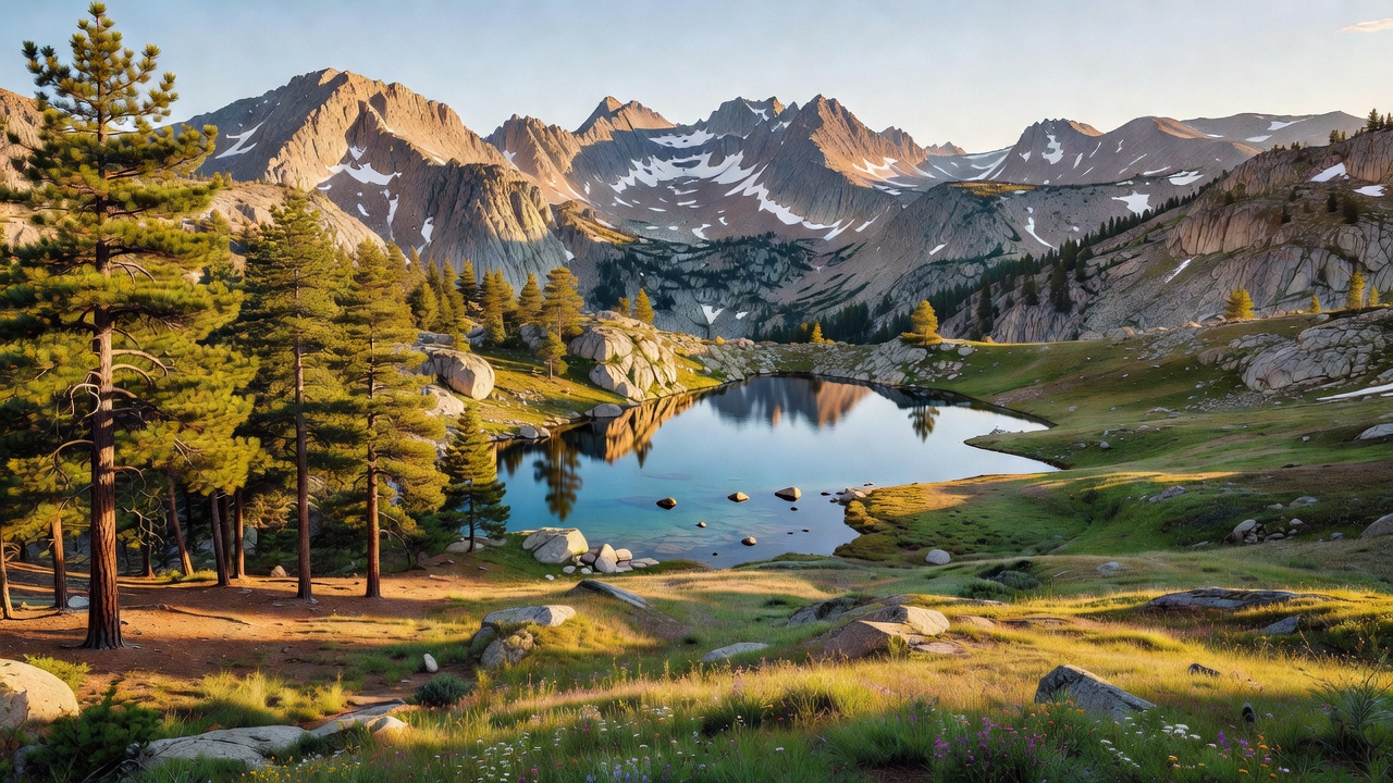
The Eagle Cap Wilderness is the other half of the forest's reputation and Oregon's largest wilderness area -- protected as a primitive area from 1930, established as wilderness in 1940 and folded into the National Wilderness Preservation System in 1964. It is a granite range: U-shaped glacial valleys, bare peaks and ridges, and high meadows, with about 534 miles of trail off 47 trailheads. Sacajawea Peak at 9,843 feet is the high point -- of the wilderness, of the Wallowas and of the whole forest -- and more than thirty other summits clear 8,000 feet. The core rock is the Wallowa Batholith: granite and granodiorite that welled up as magma between roughly 160 and 120 million years ago, with tonalite toward its outer limits. Columbia River basalt surrounds the batholith, older accreted terrane rock lies between the two, and there is marble, slate and quartzite in the mix as well -- metamorphosed remains of an ancient tropical sea, which is a strange thing to stand on at 9,000 feet in Oregon. Pleistocene glaciers did the carving and left the moraines and till in the valley bottoms. On the Whitman side, the Elkhorn Drive Scenic Byway loops the Elkhorn Mountains past Anthony Lakes, Phillips Lake and the mining ground, which makes it the easiest introduction to the forest if you have one day and a street-legal vehicle.
Camps are sourced from public U.S. Forest Service recreation data and have not been personally visited. Roads shown are Forest Service passenger-car routes (maintenance level 3–5) and may be seasonal or gated. Always confirm access, fees and fire rules with the ranger district before you go. Found a fee where we show free? Tell us on the contact page.