Baja OHV Travel Management Area
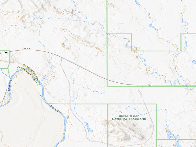
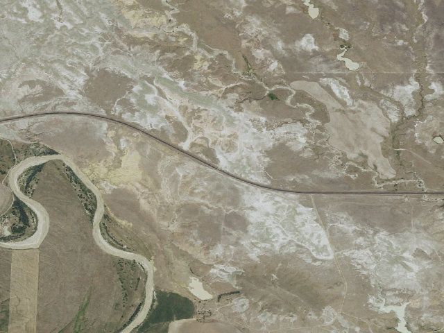
1,335 acres of open badlands on the Buffalo Gap National Grassland between Wall and Interior, free to camp on, with Badlands National Park just up the road. The Forest Service describes it as "open to motorized cross-country travel. The terrain is made up of smooth, rock-covered hills and badlands formations. The area is popular for camping, hiking, 4x4 recreation, and rock collecting." Fees: "No fees are required for this site." NO FACILITIES OF ANY KIND -- the Forest Service lists Restrooms as "none". The page does not mention water at all, so assume there is none and carry your own. THE BIG WARNING IS MUD. The Forest Service says "The area can be muddy and slippery when wet. Watch for ruts." This is badlands clay. If rain is coming, get out before it arrives rather than after -- a 4x4 does not save you from this stuff. Cattle graze here from June to October; the Forest Service asks you to be mindful of grazing operations and close every gate you open. There are active prairie dog colonies, and the Forest Service warns specifically about plague: keep dogs away from the colonies, keep up flea and tick prevention, and see a vet if your dog gets sick. Rockhounding is the draw for a lot of people. Surface collection only, no digging, up to 25 pounds per day and 250 pounds per year, no vertebrate fossils and no artifacts. Once you leave the Baja boundary onto the connecting Conata Basin trail system you must stay on designated trails. Open year-round. Grassland-wide dispersed rules apply -- 14 nonconsecutive days in any 30-day period, 100 feet back from creeks, 300 feet maximum off a road by vehicle. Wall Ranger District, (605) 279-2126. We have not visited this site.
Everything you need — measured from Baja OHV Travel Management Area · U.S. Forest Service · SD
- FFuel6 mi
- ShShower8 mi
- DDump8 mi
- GGrocery8 mi
- LLaundry9 mi
- @Mail19 mi
- EVEV fast charger20 mi
- HHardware20 mi
- +Urgent care20 mi
- MMechanic20 mi
- WWater30 mi
- RxPharmacy41 mi
- OOutfitter59 mi
The read: water is a real 30-mi drive, fuel & food sit about 6 mi out.
Not within 60 mi: Propane. Plan those before you head up.
One dot per need — the nearest of each kind, straight-line from camp. Places from OpenStreetMap (© OpenStreetMap contributors); the EV fast charger from the US DOE station locator. Open in Google Maps ↗
The site — Baja OHV Travel Management Area
Nearby & resupply — around Baja OHV Travel Management Area · U.S. Forest Service · SD (OpenStreetMap)
- Water featureWhite River (river) · nearby
- Nearest townConata · ~4.6 mi
- Drinking waternone within 10 mi
- FuelCowboy Corner · ~6.1 mi
- Propane / LPGnone within 31 mi
- Dump station~8.0 mi
- GroceriesWall Food Center · ~20.4 mi
EV charging — from Baja OHV Travel Management Area · U.S. Forest Service · SD — nearest public DC fast & Level 2 (US DOE station data)
- Nearest public DC fast charger20.3 mi straight-line N — Wall Drug Store-Wall Conoco Station (Wall, SD) · Electrify America · CCS · 4 fast ports listed · listed open, last confirmed by AFDC 2026-09-16 · hours: 24 hours daily · directions
- Public DC fast stations within reach2 within 25 mi · 2 within 50 · 17 within 100 · 29 within 150
- Nearest listing NACS (Tesla)20.8 mi — Wall, SD - Tesla Supercharger, Wall
- Nearest listing CHAdeMO61.1 mi — SECFIRSTBNK SECFIRSTBNK-A, Rapid City
- Nearest public Level 2 (J1772)49.0 mi — GismoPower MEGA - Red Cloud Renewable Energy Center, Pine Ridge, SD (at an office building) · Non-Networked · J1772 · 1 Level 2 port listed · listed open, last confirmed by AFDC 2025-01-13 · hours: 8am-5pm daily
- Pricing at the fast chargernot listed
- Power (kW)not listed by AFDC — “DC fast” spans roughly 24 to 350 kW, so ask the network.
- Read this honestlyStraight-line miles, like every distance on this site. Roads run longer than this, and you have to get back. We know where a charger is listed. We don’t know if it works today, how fast it is, or the road miles. Check the network before you commit.
Snapshot 2026-09-16 · AFDC record 203304 · US DOE Alternative Fuels Data Center
Nearby restrooms — around Baja OHV Travel Management Area · U.S. Forest Service · SD — pit toilets, restrooms & rest areas (government data)
- Restroom#259 Bigfoot Pass Picnic Area Vault Toilet · ~6.4 mi NE · NPS
- Restroom#189 Fossil Exhibit Vault Toilet · ~6.5 mi NE · NPS
- Restroom#61 CP CG Butte Loop Comfort Station · ~7.8 mi E · NPS
- Restroom#62 CP CG Agate Loop Comfort Station · ~7.9 mi E · NPS
Open Baja OHV Travel Management Area elsewhere
Other camps near Baja OHV Travel Management Area
If this one is full, gated or washed out.
- Pinnacles~14.1 mi
- Buffalo Gap National Grassland~14.6 mi
- Sage Creek Campground~20.1 mi
How we know this — Baja OHV Travel Management Area
What we don’t know about Baja OHV Travel Management Area
A land record can put you within a few meters of a spot. It cannot tell you any of this — so check it yourself, and treat anything below as the open question it is.
- Road surface & last-mile access
- How many rigs actually fit
- Cell coverage by carrier
- Seasonal & winter access
- Current fire restrictions
- Whether any water here is drinkable
- Shade & wind exposure
- Noise and who else shows up
- Whether a listed EV charger works today, or the road miles to it