Railroad Buttes OHV Area
Free dispersed camping at a Forest Service OHV area on the Buffalo Gap National Grassland, about 21 miles east of Rapid City -- close enough to be a genuinely useful stop, and it has a toilet, which most dispersed camping does not. The Forest Service page says both halves of what you need to know: "There is a large gravel parking area just through the main gate with a vault toilet. Dispersed camping is allowed but there is no potable water." and, under Fee Site and Info, "No fees are required for this site." NO WATER. Bring all of it. The area is 1,745 acres of open OHV riding split into three units -- Railroad Buttes North (the parking lot and hill climb), Railroad Buttes West, and Railroad Buttes East. This is an ACTIVE MOTORISED RIDING AREA, not a quiet spot; expect engine noise and dust on good-weather weekends. If you want silence, keep driving. SHOOTING IS PROHIBITED here and there is a formal shooting closure area in the middle of the travel management area; the Forest Service also lists an active "Railroad Buttes Shooting Prohibition" alert. Fireworks are prohibited too. Stay on designated trails and inside the boundaries open to cross-country travel, and carry the Fall River Ranger District Motor Vehicle Use Map -- the Forest Service is explicit that the MVUM is what defines legal travel and prohibitions here. Open year-round, first-come first-served, no reservations. Grassland-wide dispersed camping rules apply: 14 nonconsecutive days in any 30-day period, camp 100 feet from any creek or stream, and vehicles may leave a road by at most 300 feet. Check for fire restrictions before you light anything -- this grassland has been under Stage 1 Fire Restrictions. Fall River Ranger District, (605) 745-4107. We have not visited this site.
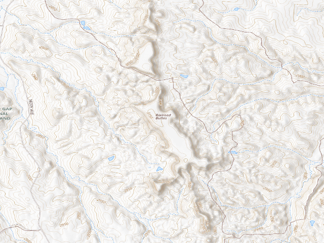
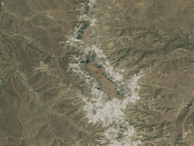
Everything you need — measured from Railroad Buttes OHV Area · U.S. Forest Service · SD
- FFuel5 mi
- GGrocery5 mi
- @Mail10 mi
- WWater15 mi
- DDump19 mi
- MMechanic21 mi
- +Urgent care21 mi
- HHardware21 mi
- EVEV fast charger22 mi
- OOutfitter22 mi
- RxPharmacy23 mi
- LLaundry24 mi
- ShShower35 mi
The read: water's a short hop out, fuel & food sit about 5 mi out.
Not within 60 mi: Propane. Plan those before you head up.
One dot per need — the nearest of each kind, straight-line from camp. Places from OpenStreetMap (© OpenStreetMap contributors); the EV fast charger from the US DOE station locator. Open in Google Maps ↗
The site — Railroad Buttes OHV Area
Nearby & resupply — around Railroad Buttes OHV Area · U.S. Forest Service · SD (OpenStreetMap)
- Nearest townCaputa · ~10.3 mi
- Drinking waternone within 10 mi
- FuelFuel · ~4.7 mi
- Propane / LPGnone within 31 mi
- Dump station~19.1 mi
- GroceriesCountry Corner · ~4.7 mi
- PharmacyAdvanced Care Pharmacy · ~22.8 mi
- Hospital / clinic28th Medical Group · ~21.3 mi
- HardwareAce Hardware · ~21.4 mi
EV charging — from Railroad Buttes OHV Area · U.S. Forest Service · SD — nearest public DC fast & Level 2 (US DOE station data)
- Nearest public DC fast charger21.5 mi straight-line NW — RCKIA RCKIAABB, Rapid City, SD · ChargePoint Network · CCS · 1 fast port listed · listed open, last confirmed by AFDC 2026-09-16 · hours: 24 hours daily · directions
- Public DC fast stations within reach8 within 25 mi · 11 within 50 · 16 within 100 · 27 within 150
- Nearest listing NACS (Tesla)22.3 mi — Granite Automotive, Rapid City
- Nearest listing CHAdeMO22.3 mi — SECFIRSTBNK SECFIRSTBNK-A, Rapid City
- Nearest public Level 2 (J1772)21.1 mi — COURTYARD BE CY STATION 1, Rapid City, SD · ChargePoint Network · J1772 · 2 Level 2 ports listed · listed open, last confirmed by AFDC 2026-09-16 · hours: 24 hours daily
- Pricing at the fast chargernot listed
- Power (kW)not listed by AFDC — “DC fast” spans roughly 24 to 350 kW, so ask the network.
- Read this honestlyStraight-line miles, like every distance on this site. Roads run longer than this, and you have to get back. We know where a charger is listed. We don’t know if it works today, how fast it is, or the road miles. Check the network before you commit.
Snapshot 2026-09-16 · AFDC record 211689 · US DOE Alternative Fuels Data Center
Nearby restrooms — around Railroad Buttes OHV Area · U.S. Forest Service · SD — pit toilets, restrooms & rest areas (government data)
- Vault / pit toiletRailroad Buttes 1 · at this camp · USFS
- Vault / pit toiletFrench Creek · ~18.4 mi SW · USFS
- Restroom#261 North Sage Creek Campground Vault Toilet · ~21.3 mi E · NPS
- Restroom#262 South Sage Creek Campground Vault Toilet · ~21.3 mi E · NPS
Open Railroad Buttes OHV Area elsewhere
Other camps near Railroad Buttes OHV Area
If this one is full, gated or washed out.
- French Creek Campground~18.0 mi
- French Creek~18.4 mi
- Sage Creek Campground~21.3 mi
How we know this — Railroad Buttes OHV Area
What we don’t know about Railroad Buttes OHV Area
A land record can put you within a few meters of a spot. It cannot tell you any of this — so check it yourself, and treat anything below as the open question it is.
- Road surface & last-mile access
- How many rigs actually fit
- Cell coverage by carrier
- Seasonal & winter access
- Current fire restrictions
- Whether any water here is drinkable
- Shade & wind exposure
- Noise and who else shows up
- Whether a listed EV charger works today, or the road miles to it