Fremont-Winema National Forest
Where the camps cluster
The place
Fremont-Winema National Forest covers about 2.3 million acres of National Forest System land across Lake and Klamath counties in south-central Oregon, run from a supervisor's office in Lakeview. The Forest Service still works it as seven ranger districts carrying both old names -- Bly, Lakeview, Paisley and Silver Lake on the Fremont side, Chemult, Chiloquin and Klamath Falls on the Winema side -- because until 2002 these were two separate forests, and they still feel like it on the ground.
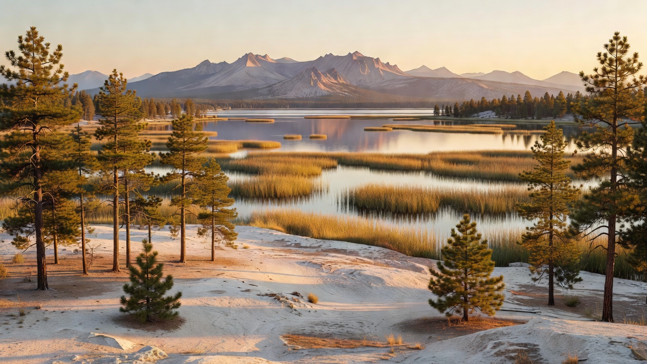
The western edge is the Cascade crest, sharing a boundary with Crater Lake National Park: wet, heavily-timbered mountain country with alpine lakes and snow that lingers. Head east and the forest dries out fast into a semi-arid highland belt of ponderosa and lodgepole pine, juniper and open sage, ending at the Warner Mountains near the California line. That eastern half is fault-block country -- horst and graben topography, long tilted crustal blocks with flat valleys dropped between them -- and it is why the landmarks out here are rims and rimrock rather than peaks. The forest's southern boundary is the Oregon-California border.
Plan around the split, because it is a real one. The Cascade side is a high-elevation summer forest where trails hold snow into July and the mosquitoes near the lakes are legendary. The eastern side is dry, open, lightly-traveled and hot in midsummer, with big distances between services. What the two halves share is pumice: the ground almost everywhere here is built on ash and tephra from Mount Mazama, which means free-draining soils, dusty roads, and surprisingly few surface streams. That pumice mantle is thickest on the Winema side and the northwestern Fremont; out east, past Winter Rim and toward the Warner Mountains, you are back on basalt and the tilted fault blocks that built the rims.
History
Two lineages meet in the hyphen. The eastern half began as the Goose Lake Forest Reserve, set aside in 1906, and became Fremont National Forest in 1908, named for John C. Fremont, who came through this country in 1843 as an officer of the Army's Topographical Corps. Fremont left his fingerprints all over the map. On December 16, 1843, camped in deep snow on the rim above a mild green valley, he wrote: 'Shivering on snow three feet deep, and stiffening in a cold north wind, we exclaimed at once that the names of summer lake and winter ridge should be applied to these proximate places of such sudden and violent contrast.' Both names stuck, and Winter Rim is still a boundary of the forest. Earlier that same year he had mapped the great scarp above Lake Abert to the east and named it for Colonel John James Abert, his commanding officer -- a name that replaced the Northern Paiute one, pa'a tikwinidi, 'high rim rock.' The Fremont absorbed part of the Paulina National Forest on July 19, 1915.
The western half has a harder story. This is Klamath, Modoc and Yahooskin homeland; the Klamath people maintained dense settlements along the Williamson River and the shores of Klamath Marsh for thousands of years. A treaty in 1864 ceded an enormous homeland -- the Klamath Tribes put it at more than 23 million acres -- in exchange for a reservation and for hunting, fishing and gathering rights held in perpetuity. Then in 1954 Congress passed the Klamath Termination Act, ending federal recognition of the tribes over the objection of the elected tribal representatives and against the Bureau of Indian Affairs' own recommendation. A large majority of enrolled members voted to withdraw and take a cash payment, and the reservation's timberland was sold off in blocks. Crown Zellerbach bought 90,000 acres; the great majority of the rest ended up in federal hands and became national forest.
Winema National Forest was established July 1, 1961, initially out of parts of neighboring national forests. The terminated reservation land came afterward, by federal purchase -- roughly 500,000 acres in 1963 and about 135,000 acres more in 1973 -- and that is how the Winema grew into the forest it is. More than 50 percent of Fremont-Winema is former Klamath Indian Reservation land. The Klamath Tribes were restored to federal recognition in 1986, but the land base was not returned; tribal members retain specific rights to hunt, fish, trap and gather forest materials on the former reservation ground. If you camp on the Chiloquin or Chemult districts, that is the land you are on.
The Winema name is itself a piece of that history. It honors Toby Riddle, a Modoc woman born about 1848 and known as Winema, second cousin to the Modoc leader Kintpuash -- Captain Jack. She and her husband Frank Riddle served as interpreters during the Modoc War of 1872-73. She warned the peace commission that an attack was coming, and when it came she saved Alfred B. Meacham's life, stopping him from being scalped. In 1891 Congress authorized her a military pension of twenty-five dollars a month, rare recognition for a Native woman at the time. She died on February 17, 1920.
The forest's most-visited piece of history is only 22.7 acres. On May 5, 1945, Reverend Archie Mitchell drove his pregnant wife Elsie and five Sunday school children out for a picnic near Leonard Creek, about eight miles east of Bly. While he parked the car, the group found the wreckage of a Japanese balloon bomb in the woods and it detonated. All six were killed: Elsie Mitchell, 26, and Dick Patzke, 14, Jay Gifford, 13, Edward Engen, 13, Joan Patzke, 13, and Sherman Shoemaker, 11. The Forest Service calls it the only location in the continental United States where Americans were killed as the result of enemy action during World War II. Japan launched roughly 9,000 of the hydrogen balloons from Honshu between November 1944 and April 1945; each was 33 feet across, rode the jet stream over in about three days, and carried four incendiaries and one anti-personnel bomb. Perhaps a thousand reached North America. Weyerhaeuser built the stone monument in 1950 -- designed by forester Tom Orr, laid up by stonemason Robert H. Anderson -- and it carries a bronze plaque with the victims' names. The site was added to the National Register of Historic Places on February 20, 2003, and a nearby ponderosa pine still scarred by the shrapnel was named an Oregon Heritage Tree in 2005.
Wildlife & plants
The forest is credited with over 300 species of wildlife and fish, and the Fremont side alone has about 925 documented vascular plants. The big game you plan around is mule deer, Rocky Mountain elk and pronghorn antelope -- pronghorn being the tell that you have left the Cascades and entered the Great Basin. Black bear, mountain lion and bobcat are all here, along with coyote, badger and porcupine. Two federally listed threatened species live on the forest: bull trout, which hold in cold headwater streams including those off Gearhart Mountain, and the northern spotted owl on the timbered west side.
Birds are the real spectacle, because this forest sits under the Pacific Flyway. Canada geese, mallards and whistling swans move through in numbers, and the wet meadows at Klamath Marsh -- the national wildlife refuge is managed specifically as fall and spring feeding habitat for waterfowl and sandhill cranes -- turn the shoulder seasons into the best birding of the year. Spring and fall, not summer, are when this place is loudest.
The trees sort themselves by how much water they can get. Ponderosa and lodgepole pine dominate, with juniper pushing in on the dry east side and white fir mixed into the middle elevations; the highest ground goes to pure lodgepole and whitebark pine, with aspen and wildflowers in the mountain meadows and tag alder and willow along the creeks. There is a lot of old growth: a 1993 estimate put about 549,800 acres of it on the Fremont and 711,674 acres on the Winema. Not all of it is healthy -- mountain pine beetle has killed extensive stands of lodgepole, including inside the Gearhart Mountain Wilderness, so expect standing dead timber and think about where you park and pitch on a windy day.
Notable features
Four wilderness areas sit at least partly inside the boundary, and they are not variations on a theme. Gearhart Mountain Wilderness is the eastern one and the forest's own: 22,823 acres in the Bly Ranger District, first set aside as a Wild Area in 1943, given wilderness status under the 1964 Wilderness Act and enlarged by 4,144 acres in 1984. Gearhart Mountain itself tops out around 8,364 feet, and on a clear day the summit gives you Steens Mountain to the east, the Cascades west, the Three Sisters north and Lassen Peak down in California. About 20 miles of trail cross it -- Deming Creek, Lookout Rock and North Fork Sprague, converging toward the summit -- and Blue Lake gets stocked with rainbow trout every year.
Mountain Lakes Wilderness is the odd one: 23,071 acres, protected on September 3, 1964, and the only wilderness area in the country whose borders form a perfect square, because it occupies exactly one 36-square-mile survey township. Inside that square is a cluster of four overlapping shield volcanoes topped by Aspen Butte at 8,208 feet, with more than 20 small lakes lying in cirques that Ice Age glaciers carved near the summits. Three trails get you in: Varney Creek at 4.5 miles, Clover Creek at 4, and the Mountain Lakes Trail at 6.5.
The two shared wildernesses are the alpine draw. Fremont-Winema holds 40,605 acres of the 116,300-acre Sky Lakes Wilderness, designated in 1984 and split with the Rogue River-Siskiyou -- more than 200 ponds and lakes, the largest being Fourmile Lake at over 900 acres, with about 35 miles of the Pacific Crest Trail running its whole length and 9,495-foot Mount McLoughlin, the highest point in the Cascades between the Three Sisters and Mount Shasta, standing over it. To the north, the forest shares the 55,100-acre Mount Thielsen Wilderness, designated by Congress in 1984. Mount Thielsen is 9,184 feet of eroded, extinct shield volcano whittled down to a spire, and its nickname is earned: the lightning rod of the Cascades.
For a long walk without a wilderness permit, the Fremont National Recreation Trail #160 -- also called the Southern Oregon Intertie Trail -- traverses most of the length of the old Fremont forest north to south, starting at Yamsay Mountain and running down to the Warner Mountains, where it ties into the Crane Mountain National Recreation Trail #161. It comes in three segments; the middle one alone, Government Harvey Pass to Cox Pass, is about 50 miles. And the geology is worth reading on the way in. Everything here is volcanic and fairly young -- crust stretched thin by tectonic shearing, letting mantle magma up -- and then, 7,700 years ago, Mount Mazama blew its top off just west of here and collapsed into the caldera that holds Crater Lake. USGS calls it the largest explosive eruption in the Cascades in the past million years and one of Earth's largest in the past 12,000. Pyroclastic flows ran as far as 70 kilometers down every valley off the mountain and ash fell across much of the Pacific Northwest and into southern Canada. The pumice you are digging your tent stakes into is the fallout.
Camps are sourced from public U.S. Forest Service recreation data and have not been personally visited. Roads shown are Forest Service passenger-car routes (maintenance level 3–5) and may be seasonal or gated. Always confirm access, fees and fire rules with the ranger district before you go. Found a fee where we show free? Tell us on the contact page.