Mt. Hood National Forest
Where the camps cluster
The place
Mt. Hood National Forest covers about 1.1 million acres of Oregon's northern Cascade Range, starting roughly 50 to 60 miles east of Portland and running some 60 miles south from the Columbia River Gorge to the Olallie Scenic Area. It touches six counties -- Clackamas, Hood River, Wasco, Multnomah, Marion and Jefferson -- and the elevation swing does most of the work: 800 feet down near the Columbia, 11,240 feet at the top of Mt. Hood, Oregon's highest point. That range is why one forest can hold, in the Forest Service's own list, rainforests, grasslands, wet meadows, oak savanna, alpine lakes and forests, and mountain glaciers. West-side country is classic Douglas fir with an understory of Oregon grape, salal, rhododendron and huckleberry; climb toward timberline and it goes to mountain hemlock, meadow and rock; drop over the crest to the east side and you are in ponderosa pine and grassland. The water matters as much as the trees -- the Forest Service says these watersheds provide drinking and/or irrigation water to about a third of Oregonians. Four ranger districts run it: Barlow (Dufur), Clackamas River (Sandy), Hood River (Mount Hood-Parkdale) and Zigzag (Zigzag), with the supervisor's office in Sandy. For visitors there are about 80 campgrounds, roughly 1,000 miles of trail, 20 sno-parks, several commercial ski areas and about 170 developed recreation sites. It is a busy forest -- it drew about 4.4 million visitors in 2006 -- so plan on company at the trailheads near the highway and go deeper if you want quiet.
History
People have been crossing this ground for a very long time, and the modern legal history starts in 1855, when the Warm Springs and Wasco tribes signed a treaty with Oregon superintendent of Indian affairs Joel Palmer, relinquishing about 10 million acres to the United States and keeping 640,000 acres for themselves. Their descendants, together with Northern Paiute people, are the Confederated Tribes of Warm Springs today, and the reservation lies south of the forest. The wagons came through almost a decade before that: in 1846 Sam Barlow and Philip Foster built the Barlow Road, the last overland leg of the Oregon Trail, roughly 100 miles from The Dalles south to Tygh Valley, west over Mt. Hood's south shoulder at Barlow Pass and down to Oregon City. It cost five dollars a wagon and ten cents a head of livestock -- about a week's wages -- and the worst of it was Laurel Hill, a 60-percent grade where wagons were lowered on ropes wrapped around trees. Three-quarters of the Willamette Valley's early settlers came in that way, and roughly 20 percent of the original road is still readable today as dirt roads, ruts and Forest Service trails. Federal protection came in pieces: President Benjamin Harrison set aside the Bull Run Forest Reserve in 1892 to guard Portland's water, and President Grover Cleveland established the vast Cascade Range Forest Reserve down the spine of the range in 1893. That reserve was carved up in 1908 -- the Oregon National Forest, created July 1 of that year out of the reserve and part of the Cascade National Forest, is this unit's direct ancestor, and it was renamed Mt. Hood National Forest in 1924. The Depression built the landmarks: the Civilian Conservation Corps put in the Timberline Trail around the mountain, most of it in the summer of 1934 for about $10,000, and the Works Progress Administration built Timberline Lodge from 1936 to 1938, with President Franklin D. Roosevelt dedicating it on September 28, 1937. In 1940 there was a serious proposal to convert the area into Mount Hood National Park; it never happened, which is why the mountain is still Forest Service ground. Wilderness protection began with the Wilderness Act of 1964 and the original Mount Hood Wilderness, and the biggest single addition came much later: the Omnibus Public Land Management Act, signed March 30, 2009, added more than 124,000 acres of wilderness here, created the 34,550-acre Mount Hood National Recreation Area in three separate units, and put 13.5 miles of the East Fork Hood River under Wild and Scenic protection (all of it classed as recreational, the most permissive of the three Wild and Scenic tiers).
Wildlife & plants
This is big-mammal country with a serious fish problem attached -- serious in the good sense, in that the forest has been working on salmon habitat since the 1980s. The Forest Service's own description of the Roaring River Wilderness names the cast plainly: salmon and steelhead spawn in the river, and the area provides habitat for bears, cougars, mule deer, elk, spotted owls and pileated woodpeckers. Elk and deer are the animals you are most likely to see and the ones the agency plans hardest around -- the East Fork Hood River corridor is called out as critical elk calving and deer fawning habitat and part of a seasonal big-game migration route, and its mid-elevation forest is suitable nesting habitat for the northern spotted owl, which is federally listed as threatened. Fish in that same corridor include steelhead, coho salmon and stocked rainbow trout, and the Salmon-Huckleberry Wilderness's two big drainages -- Eagle Creek and the Salmon River -- support healthy native fisheries. Three Watershed Restoration Action Plans (Still Creek, the Upper Sandy River and the Upper West Fork Hood River) steer the restoration work toward watersheds holding threatened or endangered fish. Go up above the trees and the wildlife gets smaller and louder: pikas and marmots work the rocky slopes at timberline on Mt. Hood. On the plant side, the headliner is a rarity -- violet suksdorfia, which grows in the moist shaded cracks of columnar basalt along the East Fork Hood River in what is described as the largest and southernmost population of the species. And in the closed Bull Run watershed west of the mountain, mature trees more than 500 years old still cover roughly half the protected area, which is the kind of forest almost nobody gets to walk through anymore.
Notable features
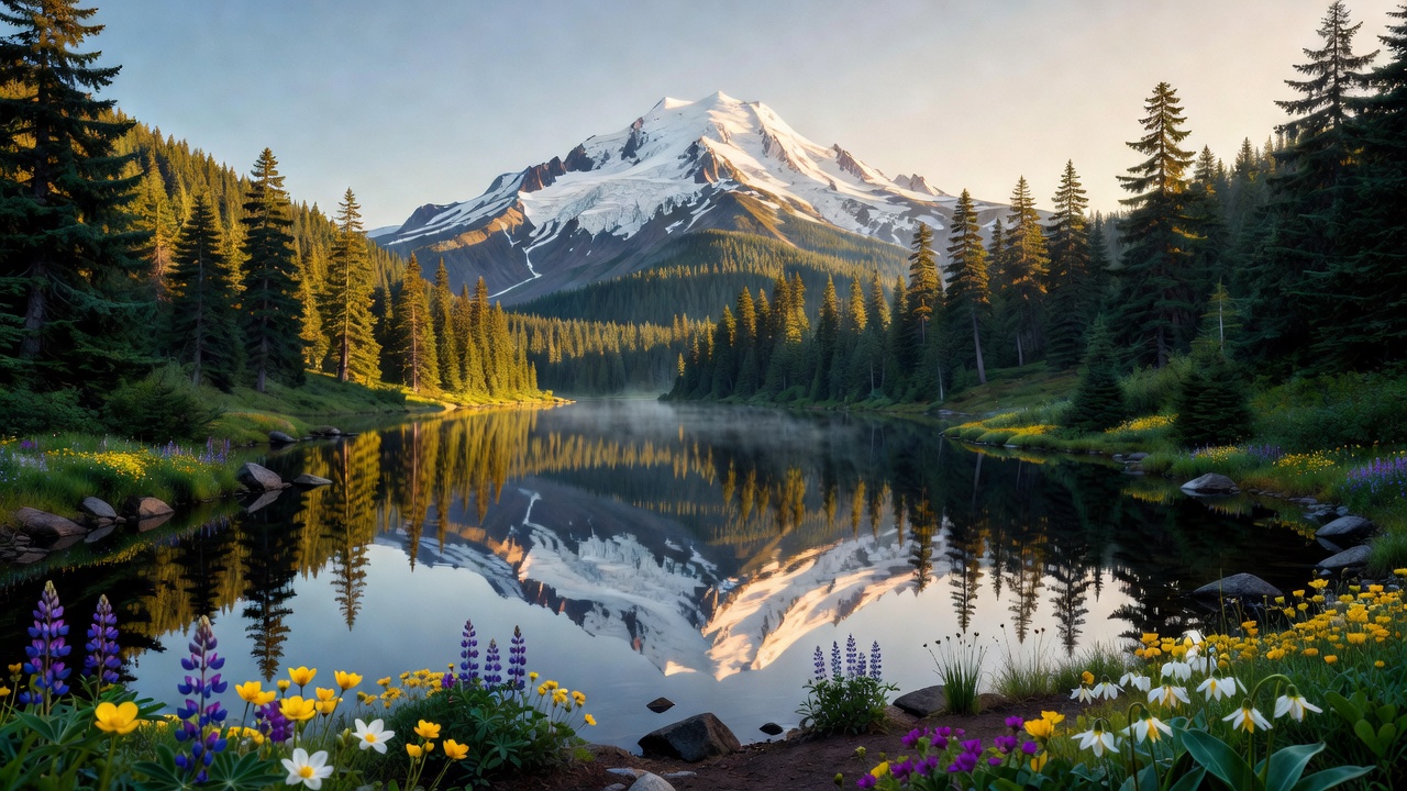
Mt. Hood itself is the whole point. It is a stratovolcano and Oregon's highest summit at 11,240 feet, with 11 active glaciers on it by the Forest Service's count, and it is not extinct -- the USGS lists it as one of the volcanoes most likely to erupt in Oregon, gives it a 'very high' threat rating, and names lahars (volcanic mudflows born when hot flows melt snow and ice, or when the steep upper slopes let go) as the main hazard. Its last substantial eruptive period began around 1781 and ran into the early 1780s, affecting the White River and Sandy River valleys, with a further eruption reported in 1865. The Cascades Volcano Observatory and the Pacific Northwest Seismic Network keep instruments on it. An estimated 10,000 climbers a year go for the summit -- a long-quoted figure rather than a headcount -- which makes it one of the most-climbed glaciated peaks in the country and also explains the accident reports -- this is a real mountain, not a walk-up. On its south flank at 6,000 feet sits Timberline Lodge, a National Historic Landmark and the forest's most recognizable building. Ringing the mountain is the Timberline Trail #600, a circuit of about 40 miles (the Forest Service still publishes 38) that shares roughly 11 miles with the Pacific Crest Trail; the PCT itself runs the length of the forest. The wilderness list is long for one unit -- the Forest Service counts roughly 279,150 acres across eight areas. Mark O. Hatfield Wilderness is the giant at 65,822 acres, stretching from about 100 feet at the Columbia River up to 4,900-foot Mt. Defiance across basalt cliffs, waterfalls and talus, with some 200 miles of trail; its southwest boundary is the Bull Run watershed. Salmon-Huckleberry (62,455 acres) is steep forested ridges, old-growth pockets and odd volcanic dikes and cliffs. Roaring River (36,768 acres, designated 2009) holds Rock Lakes and Serene Lake. Bull of the Woods (36,731 acres) runs 2,400 to 5,700 feet with about a dozen fishable lakes. Badger Creek (29,057 acres) is the east-side one -- subalpine up high, ponderosa pine and grassland down low, about 55 miles of trail. Clackamas Wilderness (9,465 acres) is five separate tracts strung along 50 miles of the Clackamas River, and Lower White River (2,873 acres) has no maintained trails and no formal access at all. For lakes, Lost Lake, Trillium Lake, Timothy Lake and Burnt Lake are the names you will hear, and the oddity is Little Crater Lake -- a cold, crystal-clear spring-fed pond that the Forest Service thinks was created by artesian water forcing its way up through soft volcanic rock and blowing a hole in it. One major piece of this forest you cannot visit: the Bull Run watershed, 143 square miles managed under the Bull Run Watershed Management Act of 1977, is largely closed to the public because it is Portland's drinking water.
Camps are sourced from public U.S. Forest Service recreation data and have not been personally visited. Roads shown are Forest Service passenger-car routes (maintenance level 3–5) and may be seasonal or gated. Always confirm access, fees and fire rules with the ranger district before you go. Found a fee where we show free? Tell us on the contact page.