Okanogan-Wenatchee National Forest
Where the camps cluster
The place
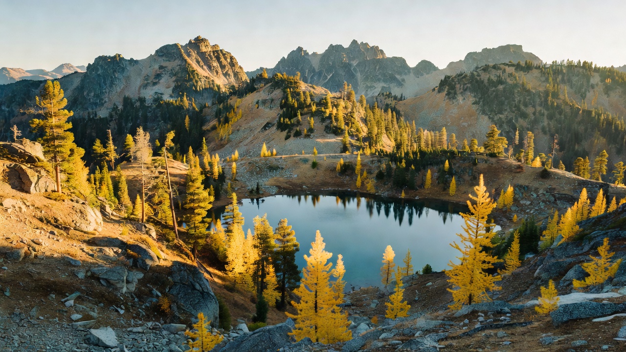
Okanogan-Wenatchee National Forest sits on the eastern slopes of Washington's Cascade Range, stretching from the Canadian border in the north down to the Yakama Indian Reservation in the south. It is one of the larger national forests in the country, and one of the most varied: within it the land climbs from dry canyon bottoms below 1,000 feet up past glacier-hung alpine peaks topping 9,000 feet along the Cascade Crest.
Because it straddles the crest's rain shadow, the forest is really two landscapes at once. The wetter western reaches carry deep, mossy stands of fir, cedar and western hemlock, while the drier east opens into ponderosa pine, western larch and open shrub-steppe country. In between lie glaciated valleys, high alpine lake basins, and long river drainages -- the Methow, the Chelan, the Wenatchee and the Naches among them -- draining the mountains toward the Columbia. Lake Chelan, one of the deepest lakes in the United States, reaches its wild upper end and the Stehekin River watershed inside the forest's bounds.
History
Today's forest is really two older forests joined together. The Wenatchee side traces its roots to the Chelan National Forest, created on July 1, 1908, while the Okanogan National Forest to the north was established on July 1, 1911. The two were combined administratively in 2000 and formally took the name Okanogan-Wenatchee National Forest in 2007. It is managed from a supervisor's office in Wenatchee, Washington, and split into several ranger districts -- among them the Chelan, Methow Valley, Naches and Wenatchee River districts. The name 'Okanogan' comes from the Okanagan people of the surrounding Columbia Plateau country.
Wildlife & plants
This is big-mammal country. The high basins and open eastern slopes support mule deer, moose, mountain goats and bighorn sheep, along with mountain lions and gray wolves, which have recolonized parts of the north Cascades. The forest's greatest wildlife distinction, though, is its cats: the Pasayten Wilderness in the forest's north is home to the largest population of Canada lynx in the Lower 48. Black bears range widely, and the rivers and cold alpine lakes hold trout. The forest cover shifts with the rain shadow -- fir, cedar and western hemlock on the wet western side; fir, ponderosa pine and western larch on the drier east -- and a 1993 Forest Service study estimated the combined forest still held on the order of 316,000 acres of old growth, much of it lodgepole pine.
Notable features
The forest's centerpiece is its wilderness. Largest by far is the Pasayten Wilderness, more than 500,000 acres of high ridges and open eastern plateaus that skirt some 50 miles of the Canadian border, laced with over 600 miles of trail and crossed by the Pacific Crest Trail. The forest also takes in part of the Alpine Lakes Wilderness, which includes the Enchantments -- a fabled string of larch-ringed granite basins and alpine tarns that draws hikers from around the world -- along with pieces of the Glacier Peak, Goat Rocks, Henry M. Jackson, Lake Chelan-Sawtooth and William O. Douglas wilderness areas. Waptus Lake, nearly two miles long and reachable only on foot or horseback, is the largest alpine lake on the forest. Beyond the wilderness lie hundreds of developed recreation sites, backcountry cabins, and the Lakeshore Trail running up remote Lake Chelan toward Stehekin.
Camps are sourced from public U.S. Forest Service recreation data and have not been personally visited. Roads shown are Forest Service passenger-car routes (maintenance level 3–5) and may be seasonal or gated. Always confirm access, fees and fire rules with the ranger district before you go. Found a fee where we show free? Tell us on the contact page.