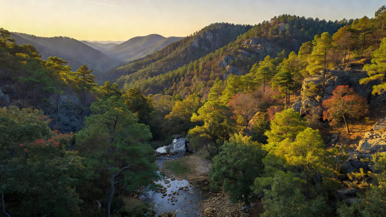
Ouachita National Forest
Where the camps cluster
The place
Ouachita National Forest fills the rugged middle of the Ouachita Mountains, spread across western Arkansas and extreme-eastern Oklahoma with its headquarters in Hot Springs. The Forest Service calls it the oldest and largest national forest in the South, and the shape of it is genuinely unusual: the Ouachitas run east-west, roughly 220 miles of long parallel ridges, which is rare in North America and is the first thing you notice from any high point. You don't get alpine drama here -- Rich Mountain, the forest's high ground and the second-highest point in Arkansas, tops out at 2,681 feet. What you get instead is horizon: ridge after timbered ridge fading blue to the west, with pine-oak woods on the slopes, clear rocky creeks in the hollows between, and lakes and float rivers below. It is also honestly a working forest -- timber sales, prescribed burns, hunting seasons, twelve ranger districts, more than any other national forest in the system -- and that texture is part of the appeal. Come in spring or fall; Ouachita summers are hot, humid, and hard on water supplies.
History
This is one of the country's early forests. It was established on December 18, 1907, under a different name -- the Arkansas National Forest -- and was renamed the Ouachita National Forest on April 29, 1926. The name itself is borrowed: 'Ouachita' is the French spelling of the Indian word Washita, meaning 'good hunting grounds.' In 1930 the forest was extended west into Le Flore County, Oklahoma, giving it the two-state footprint it has today. It came close to being something else entirely. During the 1920s there was a serious proposal to carve a 165,000-acre national park out of this country; opposed by the National Park Service and the Department of Agriculture -- likely because Hot Springs National Park was already next door -- it died by pocket veto under President Calvin Coolidge. The Civilian Conservation Corps left its mark here in the 1930s the way it did across the South; Camp Clearfork, about 20 miles west of Hot Springs on U.S. 270, was originally a CCC build. The deeper history is ecological. Heavy logging in the early 20th century, followed by decades of fire suppression, erased the fire-maintained shortleaf pine woodlands with grassy, bluestem understories that once covered these slopes -- by 1970 that ecosystem had all but disappeared. Undoing that has been the forest's defining project ever since.
Wildlife & plants
The signature wildlife story on the Ouachita is a restoration. Through forest plan amendments adopted between 1994 and 2002 and a plan revision in 2005, the forest committed to restoring roughly 250,000 acres of the old shortleaf pine-bluestem ecosystem -- thinning the pine overstory, knocking back the woody midstory, and putting fire back on the ground every three to four years. The point was the red-cockaded woodpecker, an endangered bird that needs open, park-like pine woods, and it worked: the forest's red-cockaded woodpecker population more than doubled. It turned out to carry a lot of other species with it. Forest Service research found overall abundance and species richness of butterflies, amphibians, reptiles, mammals, and birds generally greater in restored stands than in untreated controls, with northern bobwhite, prairie warbler, brown-headed nuthatch, Bachman's sparrow, and the Diana fritillary butterfly all responding well. Beyond the pine woodlands, the ridges hold northern red oak, white oak, post oak, and blackjack oak above 2,500 feet, with eastern redcedar, gum bumelia, winged elm, and yaupon along the streams. The rarest plant here is the maple-leaf oak, known from only four sites in the world -- all of them in the Ouachitas. The rivers -- the Ouachita, Caddo, Little Missouri, and Mountain Fork -- are float-and-fish water, popular for canoeing as much as for what swims in them.
Notable features
The Talimena Scenic Drive is the forest's headline: 54 miles of ridgetop road running Oklahoma State Highway 1 and Arkansas Highway 88 between Talihina, Oklahoma and Mena, Arkansas, over the Winding Stair Mountains and across Rich Mountain, with 22 scenic pull-outs and grades as steep as 13 percent. The route opened in 1969, was dedicated on June 7, 1970 by Lucy Baines Johnson Nugent, and became a National Scenic Byway in 2005. Underneath it runs the Ouachita National Recreation Trail -- 223 miles from Talimena State Park in Oklahoma to Pinnacle Mountain State Park in Arkansas, the first 192 miles of it on the national forest, with 21 trail shelters along the way. Construction started in May 1971 and finished in 1981; the first documented thru-hike was in 1983. Six wilderness areas totaling about 65,000 acres take big blocks off the motorized map: Caney Creek, Black Fork Mountain, Poteau Mountain, Dry Creek and Flatside in Arkansas, and Upper Kiamichi River in Oklahoma. On the Oklahoma side, the Winding Stair Mountain National Recreation Area covers 26,445 acres with more than 150 campsites. And for paddlers there's the Cossatot -- an 89-mile river heading up in the mountains southeast of Mena and running through the forest, rated class II to IV+ and widely called the most difficult whitewater between the Smokies and the Rockies. Its 11-mile crux, Cossatot Falls, drops about 40 feet in an eighth of a mile through rapids named Eye Opener, Washing Machine, and Whiplash; that stretch is protected as both a National Wild and Scenic River and an Arkansas Natural and Scenic River, designated April 22, 1992.
Camps are sourced from public U.S. Forest Service recreation data and have not been personally visited. Roads shown are Forest Service passenger-car routes (maintenance level 3–5) and may be seasonal or gated. Always confirm access, fees and fire rules with the ranger district before you go. Found a fee where we show free? Tell us on the contact page.