Shasta-Trinity National Forest
Where the camps cluster
The place
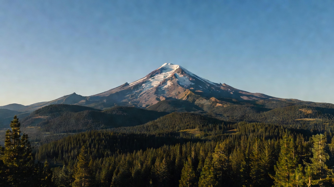
Shasta-Trinity National Forest sprawls across roughly 2.1 to 2.2 million acres of far Northern California -- the largest national forest in the state -- stitched together from the old Shasta and Trinity forests, which were administratively combined back in 1954. It straddles two very different mountain worlds: the volcanic Cascades on the east and the granite Klamath Mountains on the west. At its heart stands Mount Shasta, a glacier-clad stratovolcano rising to about 14,180 feet and dominating the skyline for a hundred miles around. To the west rise the sharp peaks of the Trinity Alps; in the middle sits Shasta Lake, the largest reservoir in California by capacity; and wild rivers -- the Trinity, the McCloud, the upper Sacramento -- cut deep canyons through the whole of it.
History
The Trinity River country was struck by gold early: prospectors were working its bars in 1848, right on the heels of the Coloma strike, and the rush spilled into the 1850s with boomtowns like Weaverville. Long before that -- and still today -- this was homeland to several Indigenous peoples, including the Wintu, Winnemem Wintu, Shasta, and Karuk, for whom Mount Shasta remains a living sacred mountain. The land was set aside as federal forest reserves in 1905, and the Shasta and Trinity forests were joined into a single administrative unit in 1954. The biggest human mark is Shasta Dam, completed around 1945 as a keystone of the Central Valley Project: it plugged the Sacramento River to create Shasta Lake and, in the process, flooded canyons along with village and ceremonial sites of the Winnemem Wintu on the upper river -- a loss the tribe still speaks about.
Wildlife & plants
Black bears roam throughout, so store your food, along with mountain lions and black-tailed deer (the coastal branch of the mule deer family). Elk turn up in places thanks to reintroduction and slow range recovery -- the wetter northwest edge of this corner of the state is Roosevelt elk country, while herds out toward Shasta Valley are actually Rocky Mountain elk, a different animal. The rivers are the showpiece: the Trinity and its tributaries carry salmon and steelhead (heavily managed, but iconic), and the cold, clear McCloud is legendary trout water. Bald eagles and ospreys work the lakes, Steller's jays scold through the pines, and the forest climbs from oak and ponderosa up into fir and, high on Shasta and in the Trinity Alps, into subalpine hemlock and whitebark pine.
Notable features
The crown jewel is Mount Shasta -- a potentially active stratovolcano near 14,180 feet, the second-highest peak in the Cascade Range (after Rainier) and generally considered its most voluminous, still carrying named glaciers like the Hotlum and Whitney, though they've been shrinking in recent decades. To the west, the Trinity Alps Wilderness protects a maze of granite peaks and alpine lakes across roughly half a million acres -- one of California's largest wilderness areas (and the second-largest run by the Forest Service, after the John Muir) -- shared with neighboring forests. Shasta Lake, held back by Shasta Dam, is the state's largest reservoir by capacity, with around 365 miles of crenellated shoreline at full pool and a big houseboat culture. Wild stretches of the Trinity, McCloud, and upper Sacramento rivers thread the forest, and its far eastern edge runs into the dark lava country of the Medicine Lake Highlands.
Camps are sourced from public U.S. Forest Service recreation data and have not been personally visited. Roads shown are Forest Service passenger-car routes (maintenance level 3–5) and may be seasonal or gated. Always confirm access, fees and fire rules with the ranger district before you go. Found a fee where we show free? Tell us on the contact page.